

Latest Weather Blog
Monday evening video forecast
Related Story
Chilly temperatures will stick around through midweek. In fact, after a brief warm up, a cold front on Friday will keep below average temperatures in the forecast through the weekend.
Tonight & Tomorrow: Mainly clear skies are expected overnight. It will feel brisk with northeast winds of 10-15mph. If not for those winds keeping the atmosphere mixed up a little bit, low temperatures would be able to drop further than the low 40s that are expected. You will certainly want a jacket on Tuesday morning. Plenty of sunshine will be around early, working against those crisp northeast breezes to push high temperatures into the low 60s. Expect clouds to increase late in the day. A stray shower will be possible, manly after dark and especially north of I-12.
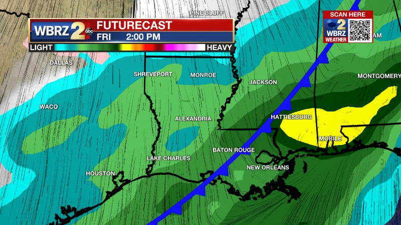
Up Next: Keep the light jacket around for Wednesday as low temperatures make it into the low 40s. More sun and faster warming are expected with highs reaching the 70s during the afternoon. South winds will quickly return seasonably mild air and moisture to the area and so Thursday will move from the 50s to 70s with increasing clouds. A cold front will bring organized rain and thunderstorms to the region on Friday. This activity has been trending faster and is expected to end Friday night. Much cooler air will return for the upcoming weekend. Layers will be needed for outdoor events like the Wearin’ of the Green parade.
Get the latest 7-day forecast and real time weather updates HERE.
Watch live news HERE.
--Josh
The Storm Station is here for you, on every platform. Your weather updates can be found on News 2, wbrz.com, and the WBRZ WX App on your Apple or Android device. Follow WBRZ Weather on Facebook and Twitter for even more weather updates while you are on the go.
News
