

Latest Weather Blog
ALL CLEAR from severe weather; big-time cooldown underway
The Tornado Watch was cancelled a few hours early for all parishes/counties in the Storm Station coverage area. There is no longer any threat of severe weather locally. As overnight storms continue pulling away, a brisk northwest wind has already started ushering in a significant cooldown for the Gulf Coast.
Today & Tonight: Low clouds may linger for a few hours early Monday, but eventually skies will transition to a mixture of sun and high clouds. Jackets or heavier coats will be needed by morning, with wake-up temperatures in the 40s. A northwest breeze will place wind chills into the upper 30s. The added sunshine won't help temperatures warm too much, with highs only topping out in the mid-50s. The wind will be hard to miss, with sustained speeds of 15-25 mph and gusts topping 30-35 mph.
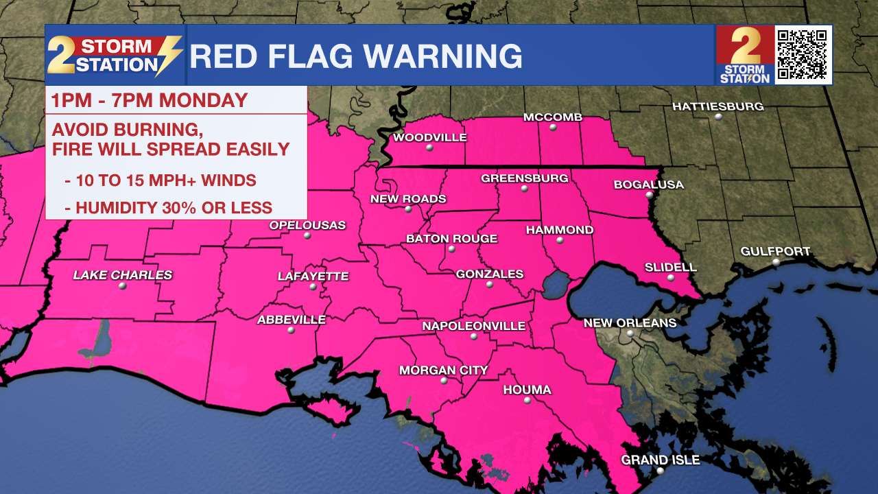
Coupled with the very dry air that will also be moving in, the breeze will create a fire weather danger. A Red Flag Warning has been issued for all of southeast Louisiana from 1 p.m. to 7 p.m. Monday. The combination of winds over 15 mph and very dry air will promote rapid widespread spread, should anything ignite. Avoid burning outdoors, dispose of cigarettes properly, and remain cautious while using equipment that can spark.
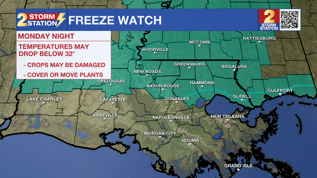
The coldest part of the Storm Station forecast comes early Tuesday. A light freeze is expected along and north of I-10/12, with frost conditions south of the highways. Those who have planted their spring gardens will need to take action to protect plants. People and pets will also need a warm shelter. A Freeze Watch has been issued for areas north of I-10/12 on Tuesday morning, likely to be upgraded to a Warning later in time.
Trending News
Up Next: Temperatures will gradually moderate throughout the rest of the workweek, with generally dry conditions prevailing. As the week wraps up and spring begins, expect highs to return to the 80s.


Get the latest 7-day forecast and real-time weather updates HERE.
Watch live news HERE.
— Meteorologist Malcolm Byron
The Storm Station is here for you, on every platform. Your weather updates can be found on News 2, wbrz.com, and the WBRZ WX App on your Apple or Android device. Follow WBRZ Weather on Facebook and X for even more weather updates while you are on the go.
More News
