

Latest Weather Blog
Friday AM Forecast: Cool & dry today, wet & cloudy pattern ahead
Black Friday will bring another round of pleasant weather with cool, dry conditions. By late weekend, skies turn overcast and several rounds of rain move in.
Today & Tonight: After a cold start in the 30s, afternoon highs will climb into the upper 50s to low 60s. Temperatures will run a bit cooler today as high clouds filter the sunshine. Tonight, clouds continue to build and lows rise into the lower 40s.
Football Forecasts: Friday night football across the Capital Area looks ideal, with mostly clear skies, calm winds, and temperatures sliding into the 40s by halftime—definitely a night for an extra layer. Southeastern Louisiana’s playoff matchup should kick off on a dry note, though clouds will thicken as the day goes on and a brief shower can’t be ruled out before the game wraps up. For the Bayou Classic in New Orleans, conditions will be mild and dry heading in, but increasing clouds and a slight chance of showers may greet fans on the trip home. As for LSU’s visit to Oklahoma, expect a damp, chilly setup with some morning rain and temperatures dropping from the 50s into the 40s during the afternoon.

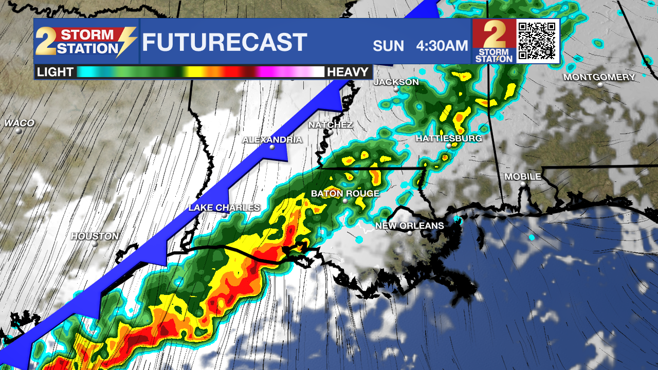
Up Next: Winds will shift out of the south on Saturday, bringing in more moisture and increasing cloud cover. A few light, isolated showers may pop up, but most areas should stay dry. Highs will climb into the upper 60s and low 70s. A cold front arrives early Sunday, producing numerous showers and a few thunderstorms. Around 1 inch of rain is expected with this first round. The second half of Sunday should trend drier, though not necessarily completely dry. Clouds will linger, and the sun may not break through at all. Temperatures will cool next week, but another system will be quick to follow.
Trending News
Round #2 moves in Monday as an area of low pressure tracks nearby. Most locations will see rain again, and totals could be higher than Sunday’s—generally 1–2 inches with isolated heavier amounts. Clouds will hold firm throughout the day. Late Monday into Tuesday, yet another front passes through, sending temperatures even lower and dropping overnight lows back into the 30s. Sunshine finally returns by midweek.
The Tropics: For the Gulf, Caribbean, and Atlantic, all is quiet. No new tropical development is expected over the next seven days.
Get the latest 7-day forecast and real-time weather updates HERE.
Watch live news HERE.
– Balin
The Storm Station is here for you, on every platform. Your weather updates can be found on News 2, wbrz.com, and the WBRZ WX App on your Apple or Android device. Follow WBRZ Weather on Facebook and X for even more weather updates while you are on the go.
More News
