

Latest Weather Blog
Friday PM Forecast: first fall front delivers cool, dry and windy conditions for the weekend
A strong cold front will move offshore tonight, bringing in much cooler temperatures for the weekend. While the front will bring a major reduction in temperatures and humidity, it will also deliver gusty winds, elevated fire risks, and rough water for boaters.
Weekend Temperature Tumble: The latest Storm Station forecast has knocked temperatures down another notch behind the passing cold front. Saturday will start off chilly in the lower 50s, with afternoon highs struggling to get much higher than the mid-70s thanks to a brisk northeast wind at 10–20 mph. Sunday morning will also have a crisp, cool start with lows dipping into the lower 50s and even upper 40s along and north of I-12. While Sunday afternoon will end up slightly warmer than Saturday, temperatures will still top out in the 70s.
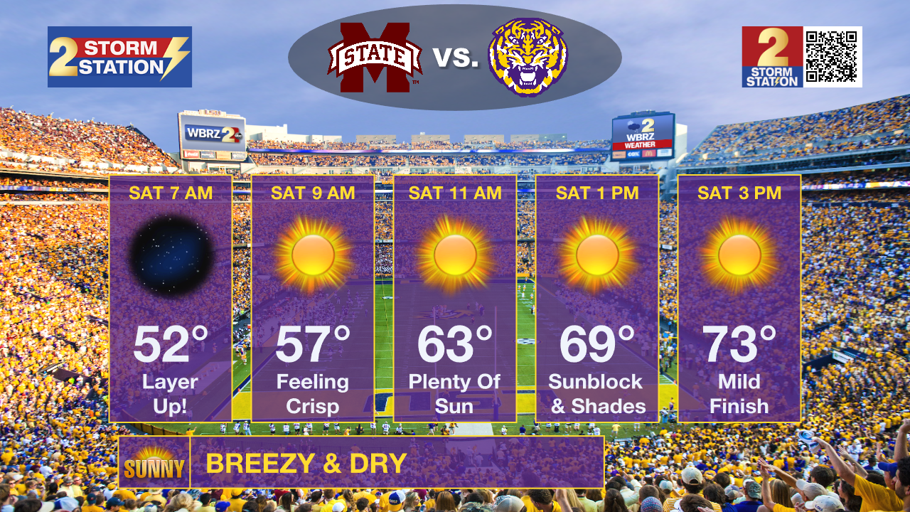
LSU Homecoming: Get ready for classic fall football conditions on Saturday. Thanks to Friday afternoon's cold front, morning festivities and tailgates will be rather cool, with temperatures in the 50s. Sunshine will warm temperatures into the 60s by kickoff and 70s by the end of the game. Due to windy and dry conditions, lip balm and moisturizer may come in handy and don't forget sunscreen for a rare day game in Death Valley.
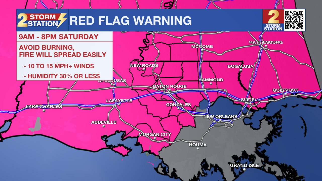
Fire Weather Danger: Saturday's dry and breezy setup will create prime conditions for elevated fire danger. With humidity dropping to its lowest during the daytime, any stray spark could quickly catch and spread. A Red Flag Warning has been issued to encourage avoiding open outdoor burning. If you are using a grill or handling any open flame outside, keep a close eye on it at all times.
Trending News
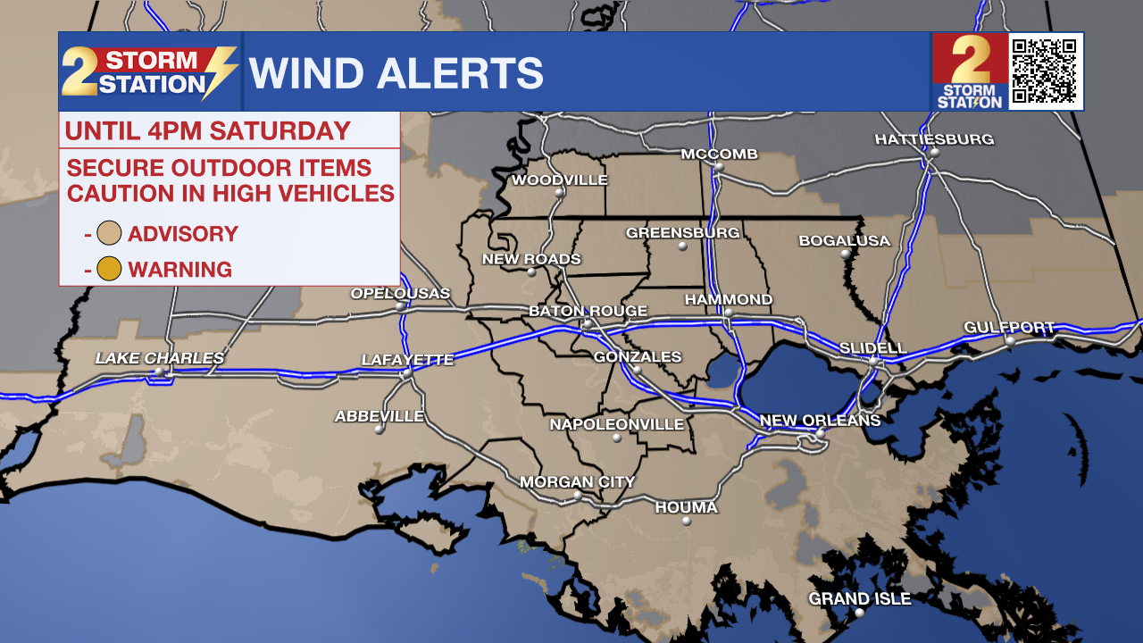
Wind Advisory: A wind advisory is in effect until 3 pm Saturday as north winds of 15 - 25 mph are expected with gusts up to 35 mph. These winds will blow around unsecured objects. Tree limbs could be blown down, and a few power outages may result. Winds this strong can make driving difficult, especially for high-profile vehicles.
Hazardous Marine Conditions: If you have plans to be out on the water through Saturday, you will likely want to rethink them—particularly if you are driving a smaller boat or lack experience in rough conditions. A Gale Warning has been issued as strong, gusty winds are set to churn up choppy waters across local lakes and rivers.
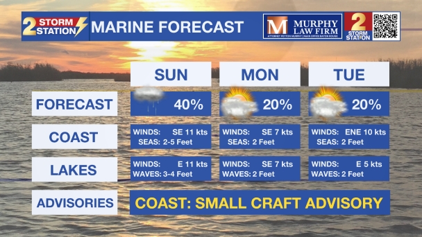
Up Next: Following the significantly cooler weekend, temperatures will slowly rebound next week. Dry air will remain in place, however, keeping rain chances generally slim.

Get the latest 7-day forecast and real-time weather updates HERE.
Watch live news HERE.
The Tropics: All is quiet in the Atlantic, Gulf, and Caribbean. No tropical development is expected over the next seven days.
— Josh
The Storm Station is here for you, on every platform. Your weather updates can be found on News 2, wbrz.com, and the WBRZ WX App on your Apple or Android device. Follow WBRZ Weather on Facebook and X for even more weather updates while you are on the go.
More News

