

Latest Weather Blog
Monday AM forecast: Hot and dry locally, Possible development in the Atlantic
Same pattern, same forecast. Warm afternoons, quiet weather, and just a slim chance of a spotty shower.
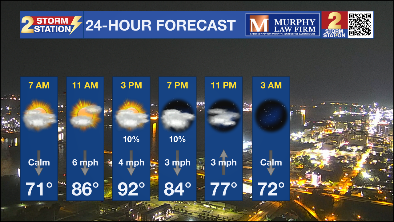
Today and Tonight: High pressure remains locked in place, keeping rain chances very low. Most areas will remain dry, although a brief shower can’t be ruled out. Highs will run warmer than average in the low 90s, with overnight lows dropping into the upper 60s north and low to mid 70s south.
Up Next: The quiet, persistent pattern holds through midweek. High pressure over the central U.S. will keep our weather steady, with near-normal lows, above-normal highs, and only a stray shower or storm possible. By late week, a new trough digs into the central U.S., but most of the forcing stays north. Thursday through Saturday, temperatures will remain on the warm side.
The Tropics: A tropical wave over the eastern Atlantic is producing widespread showers and thunderstorms. Conditions should become more favorable for development this week. The National Hurricane Center gives the system a 80% chance of becoming a tropical depression as it tracks west-northwest across the central Atlantic.
Trending News
.png)
Get the latest 7-day forecast and real-time weather updates HERE.
Watch live news HERE.
– Dave
The Storm Station is here for you, on every platform. Your weather updates can be found on News 2, wbrz.com, and the WBRZ WX App on your Apple or Android device. Follow WBRZ Weather on Facebook and X for even more weather updates while you are on the go.
More News
