Saturday PM Forecast: Rest of Labor Day weekend much drier, eyes on midweek front
Drier air will work its way in over the next few days, greatly reducing rain chances. Looking ahead to the middle of next week, a strong front sweeping the country will likely pass the area, leading to an early taste of fall.
Labor Day Weekend: Most storms that did form today, will begin to dissipate overnight. Expect lows near 72 degrees under partly cloudy skies. The stalled front that has been draped across the area the last few days will be situated close to the coast on Sunday. This boundary is the dividing line between moist and dry air. Given the expected position of the front, most across the area will stay dry, with some even receiving lower humidity. Down closer to the coast, humid conditions and the chance for storms will remain. Highs will top out near 90 degrees under partly sunny skies. Nearly the exact same pattern will take place on Labor Day, meaning outside plans will be good to go!
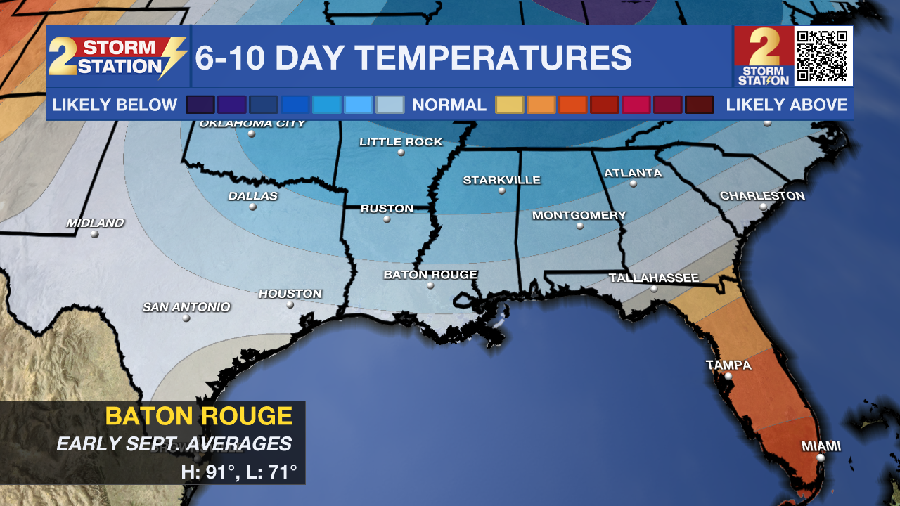
Up Next: Another front will be sweeping the country next week, and this one looks the be the strongest of the late summer period so far. Some parts of the United States will see much below average temperatures. This air mass will moderate as it moves towards us, but slightly below average temperatures will be possible. Here is how we get there.

On Tuesday, this front will be approaching the Capital Area. Available moisture will not be overly high, so only a slight uptick in rain chances is expected. Latest guidance shows a Tuesday night front passage, with really dry air filtering in for the rest of the week. One thing is for sure, humidity will not be a thing all the way through the first half of the weekend, which is great for LSU's first home game! As for temperatures, lows will drop into the mid to upper 60s, but highs will remain near 90 degrees. It's not a significant front, but you will still feel the difference.
Trending News
The Tropics: A tropical wave is forecast to emerge off the west coast of Africa on Sunday. Thereafter, environmental conditions could support some slow development of this system while it moves westward to west-northwestward at around 15 mph across the eastern and central tropical Atlantic next week.
Get the latest 7-day forecast and real-time weather updates HERE.
Watch live news HERE.
-- Balin
The Storm Station is here for you, on every platform. Your weather updates can be found on News 2, wbrz.com, and the WBRZ WX App on your Apple or Android device. Follow WBRZ Weather on Facebook and X for even more weather updates while you are on the go.


