

Latest Weather Blog
Sunday PM Forecast: From ice-cold nights to near 70 degrees
Expect “improvements” in temperature as the new workweek begins. Such a warming trend will eventually give way to showers ahead of the next cold front, which arrives around midweek.
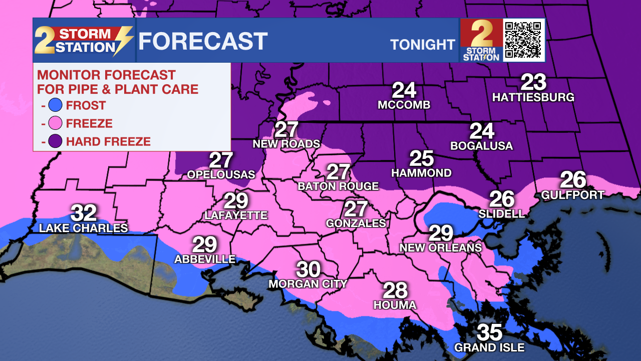
Tonight & Tomorrow: Clear skies and generally light winds will set up another cold night, though not as frigid as the previous night. Still, another hard freeze is possible near and northeast of Baton Rouge as lows slip into the middle and upper 20s. Continue taking precautions to protect all “4 P’s” to ensure warmth for people, pets, plants, and pipes. Allowing a slow drip for indoor faucets and opening cabinets to allow warm air to circulate can add peace of mind when protecting pipes. Fortunately, the wind chill will not be much of a factor for people and pets. Abundant sunshine will push highs closer to the seasonal average by afternoon, reaching the low 60s.
Up Next: After Monday morning, temperatures will remain above freezing for a few days. After a low in the 40s, highs on Tuesday could flirt with 70° despite an uptick in cloud cover and the occasional sprinkle. This warmth comes ahead of another cold front, which will bring a wave of showers and a few rumbles of thunder on Tuesday night. Depending on the timing, there’s a chance rain might linger into the Wednesday morning drive. In any event, rain will depart fairly quickly on Wednesday as cooler air invades again. However, this cooldown won’t be nearly as severe as the last two Arctic blasts. Moving toward next weekend, temperatures will rebound quickly under mainly sunny skies.

Trending News
Get the latest 7-day forecast and real-time weather updates HERE.
Watch live news HERE.
— Meteorologist Malcolm Byron
The Storm Station is here for you, on every platform. Your weather updates can be found on News 2, wbrz.com, and the WBRZ WX App on your Apple or Android device. Follow WBRZ Weather on Facebook and X for even more weather updates while you are on the go.
More News
