

Latest Weather Blog
Sunday PM Forecast: Series of fronts will bring rain and dramatic temperature swings
The cycle of foggy starts and warm afternoons will be broken this week. Expect several rounds of rain and highly variable temperatures tied to numerous frontal passages.
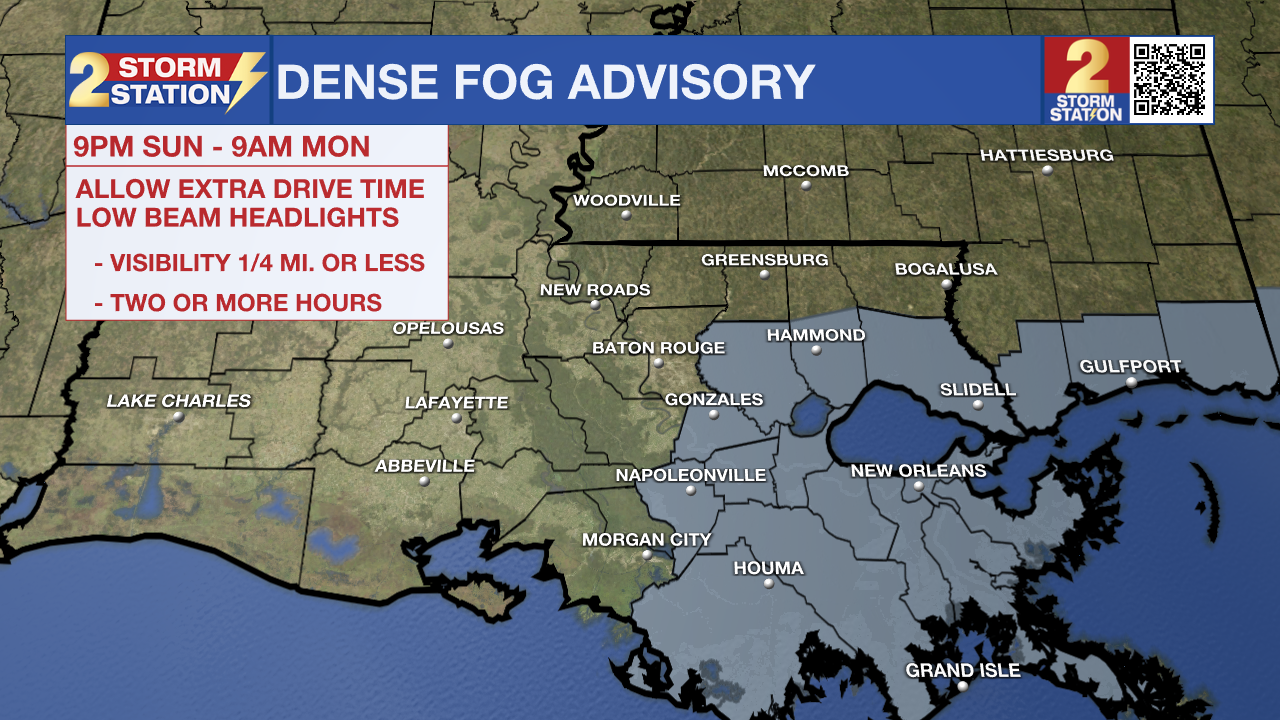
Tonight & Tomorrow: The fog potential looks a little different from recent nights. Patchy fog will develop first in marine areas and attempt to drift northward with time. However, a cold front arriving from the north will fight against the northward advance of the fog by introducing a drier air. The front should arrive in time to limit any fog potential for areas along and north of the interstate system. However, coastal sections and areas south of I-10/12 might have a brief window in the predawn hours where patchy fog could develop. Even there, the threat would diminish closer to sunrise as the cold front continues south. A *DENSE FOG ADVISORY* will be in effect from 9 p.m. Sunday to 9 a.m. Monday for areas that could be affected.
Fog aside, there should still be plenty of clouds. A stray shower is not out of the question either, but there won't be too many. Lows will vary from near 50° in southwest Mississippi, to the upper 50s in Baton Rouge, and low 60s along the coast. The rest of Monday will be mostly cloudy, and noticeably cooler on the other side of the front. Look for a high in the low 70s.
Up Next: The long-term forecast features several frontal passages. This will result in several rounds of rain and highly variable temperatures throughout the rest of the week. All told, 1-3” of rain is expected in the next week, with northern communities likely seeing totals on the higher end of that range.
Tuesday/Wednesday: A warm front will surge northward through the Capital Area on Monday night, making things warm again. Near-record warmth will again be a possibility on Tuesday and Wednesday as highs soar into the lower and middle 80s. Be on the lookout for some spotty showers for Tuesday and Tuesday night, but the bulk of the rain will fall to the north. A better shot at rain arrives on Wednesday as another cold front approaches.
Thursday/Friday: While not zero, rain chances will lessen for the final part of the workweek. Temperatures will also return to more seasonable levels with highs in the 60s.
Trending News
Saturday/Sunday: Another warm front will pass through on Saturday, reintroducing another round of warmth and mugginess. This will set the stage for another round of showers and thunderstorms by Saturday night. Finally, a cold front will sweep the rain out early Sunday with some cooler air filtering in behind. Expect a cooler second half to the weekend.
Get the latest 7-day forecast and real-time weather updates HERE.
Watch live news HERE.
-- Meteorologist Malcolm Byron
The Storm Station is here for you, on every platform. Your weather updates can be found on News 2, wbrz.com, and the WBRZ WX App on your Apple or Android device. Follow WBRZ Weather on Facebook and X for even more weather updates while you are on the go.
More News
