

Latest Weather Blog
Thursday PM Forecast: wildfire could lead to superfog in some areas tonight
Through the weekend, expect a continuation of morning fog followed by unseasonably warm and sunny afternoons. Any outdoor activities will be in fine shape. The arrival of the next cold front continues to slow down, so significant rain chances do not return until at least Tuesday.
A *DENSE FOG ADVISORY* is in effect from 8pm tonight through 10 am Friday. Fog may cause visibility of one-quarter mile or less and could make driving conditions hazardous. If driving, slow down, use your low-beam headlights, and leave plenty of distance ahead of you.
A wildfire burning southwest of New Orleans could help to thicken fog near the Crescent City tonight. The mix of smoke and natural fog would create what is known as superfog, and could result in extremely low visibilities and dangerous driving—particularly in St. John, Jefferson and Orleans Parishes. Those commuting to New Orleans for work or Super Bowl festivities should be advised.
There's a wildfire southwest of New Orleans. The smoke is blowing into the NOLA metro.
— Malcolm Byron (@mbyronwx) February 6, 2025
This might lead to problems tonight if it can mix with fog, creating a very hazardous "Superfog" setup on the roads. Use EXTRA caution is traveling towards New Orleans early Friday. pic.twitter.com/5UcM2WgSaZ
Tonight and Tomorrow: Expect another mild night with a low of around 64. Mostly clear skies early will give way to some fog, especially near bodies of water. The unseasonably warm weather will continue on Friday with a high near 83, matching the record previously set in 2019. Any fog and low clouds early will give way to plenty of sun.
Up Next: Fog will continue to be the main weather concern into the weekend. After any reduced visibility near daybreak, both afternoons will feature mostly sunny skies. Temperatures will stay unseasonably warm with highs in the mid-80s and lows in the mid-60s. By Monday, a cold front is expected to move toward the Capital Area. Initially, this front should bring some rain showers, but the atmosphere won’t have much energy and thunderstorms are unlikely. This front will move slowly and could even stall north of the I-10/12 corridor into Tuesday.
Trending News
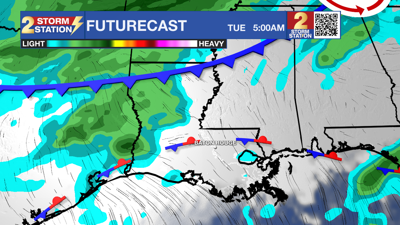
Expect a more unsettled weather pattern to unfold Tuesday and beyond. Several disturbances will pass through the region as a boundary meanders between I-20 and the coast. These factors will combine to bring periods of rain and a few thunderstorms. Heavy rain could become an issue, especially if it falls at a rate of more than an inch per hour. Since vegetation is dormant, there could be more runoff, increasing the risk of localized flooding. Temperatures will stay mild, with lows in the lower 60s and highs in the mid to upper 70s.
Get the latest 7-day forecast and real-time weather updates HERE.
Watch live news HERE.
– Josh
The Storm Station is here for you, on every platform. Your weather updates can be found on News 2, wbrz.com, and the WBRZ WX App on your Apple or Android device. Follow WBRZ Weather on Facebook and X for even more weather updates while you are on the go.
More News
