

Latest Weather Blog
Tuesday AM Forecast: Isolated showers midweek, possible ice over weekend
Temperatures will increase, along with rain chances by the middle of the week. Winter returns this weekend, and while nothing is locked in yet, some could even see wintry weather.
Today & Tonight: Tuesday will feel a lot like Monday, with afternoon highs hovering near 60 degrees. High-level clouds will gradually stream in during the day, hinting at changes on the way for midweek. Cloud cover will continue to build and thicken overnight, helping temperatures stay milder. Morning lows will only dip into the mid to upper 40s.
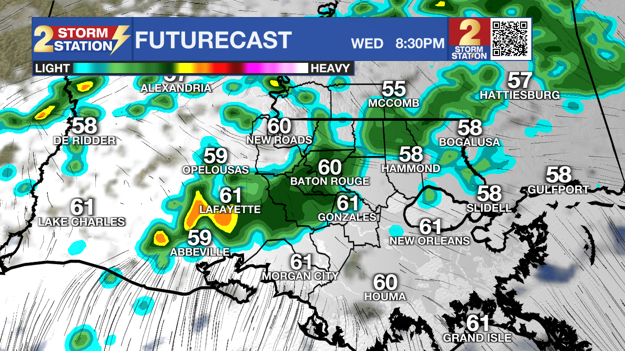
Midweek Rain: Wednesday will be dominated by cloud cover as the next weather system moves in, bringing another chance for rain. Shower activity will increase as we head into the afternoon and evening, creating slick roads in some spots. Even with the gloomy skies, a southeast breeze will help temperatures climb into the low to mid 60s. As this system pulls away Thursday and Friday, rain chances will taper off, though a brief, passing shower can’t be ruled out. Overall, the latter half of the week will trend warmer, with highs approaching 70 degrees and overnight lows holding in the 50s.
Winter Returns: A new weather system is expected to develop on Saturday, bringing yet another round of rain to the area. At the same time, a bitter Arctic air mass will start pressing south toward the Gulf Coast. This setup raises concern for winter weather, particularly near the I-20 corridor, where freezing rain is looking more and more possible. If temperatures fall fast enough Saturday night, freezing rain could even sneak as far south as the I-10 corridor.
Trending News
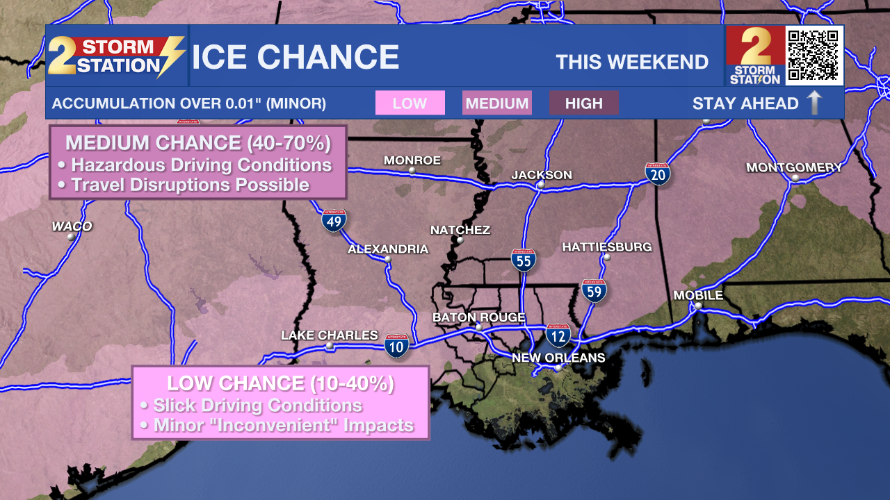
At this point, the Storm Station is favoring a freezing rain scenario mainly north and west of Baton Rouge, while areas farther south would see mostly cold rain. Even if rain is the only precipitation, lingering moisture on bridges and elevated roadways could freeze by Sunday morning, creating hazardous travel conditions. With a setup this sensitive, small changes in the forecast could have big impacts, so it’s important to check back as confidence improves later this week.
By Sunday into early next week, rain will end quickly and the cold will take center stage. Expect highs only in the 40s on Monday, with morning lows dropping into the 20s.

Get the latest 7-day forecast and real-time weather updates HERE.
Watch live news HERE.
— Balin
The Storm Station is here for you, on every platform. Your weather updates can be found on News 2, wbrz.com, and the WBRZ WX App on your Apple or Android device. Follow WBRZ Weather on Facebook and X for even more weather updates while you are on the go.
More News
