

Latest Weather Blog
Wednesday AM forecast: Sunny and warmer, watching another Arctic front this weekend
Cold eases slightly on Wednesday, but winter isn’t done yet. After the coldest stretch of the season, temperatures begin a slow climb while eyes turn to another Arctic surge late week.

Today and tonight: We’re starting cold, but not as harsh as the past few mornings, with early temperatures in the upper 20s to low 30s before sunrise. Sunshine dominates through the day, allowing temperatures to recover into the upper 40s to near 50 by afternoon — still below normal, but a noticeable improvement. Winds are lighter, making the cold more manageable. Clear skies return Wednesday night, with lows dipping back into the upper 20s and low 30s across much of the area.

Use the slider to advance through the next 24 hours of Futurecast
Trending News
Up Next: Thursday stays dry and chilly with highs near 50 before attention shifts to late Friday into Saturday. Another strong Arctic front is increasingly likely, bringing the potential for a renewed blast of dangerous cold heading into the weekend.
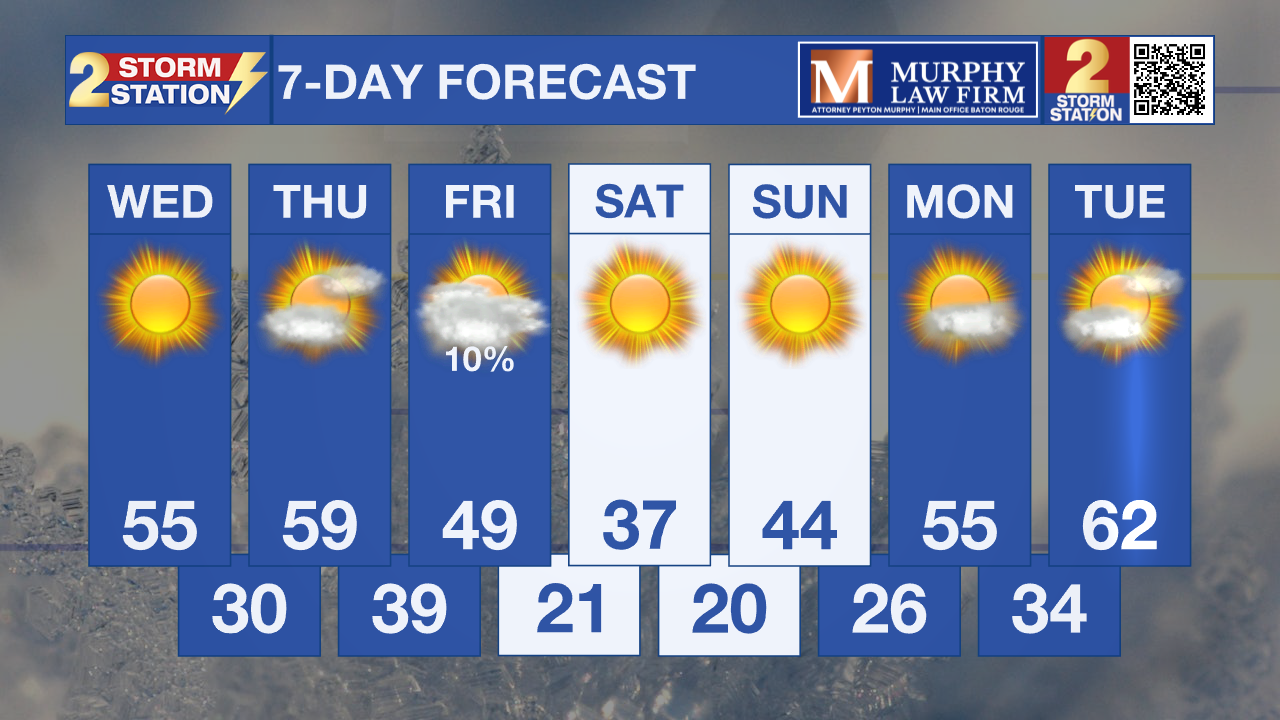
What to look out for: While the worst of the extreme cold is ending, freezing temperatures remain possible overnight through midweek. Confidence continues to increase in another significant cold outbreak late Friday into Saturday, which could rival or exceed this week’s cold in intensity.
Get the latest 7-day forecast and real-time weather updates HERE.
Watch live news HERE.
– Dave
The Storm Station is here for you, on every platform. Your weather updates can be found on News 2, wbrz.com, and the WBRZ WX App on your Apple or Android device. Follow WBRZ Weather on Facebook and X for even more weather updates while you are on the go.
More News
