

Latest Weather Blog
Wednesday PM Forecast: One more foggy start ahead of the next rainmaker
Another DENSE FOG ADVISORY has been issued for the majority of southeast Louisiana, lasting from 11 p.m. Wednesday through 9 a.m. Thursday. Quarter-mile visibility or less will be possible across much of the region. Remain cautious during the morning drive by taking it slow, using low-beam headlights, and leaving plenty of space between other vehicles. Though not a widespread concern, locations near any active or smoldering agricultural fires could see super fog development with near-zero visibility due to smoke mixing in.
Tonight & Tomorrow: Expect fog to thicken overnight and early Thursday, thanks to mostly clear skies and calm winds. Poor visibility will be an issue for yet another morning commute, so be prepared for possible delays on the way to work or school. Wake-up temperatures will be in the low 60s. Fog will lift by mid-to-late morning, leaving a partly to mostly cloudy sky for the afternoon. Look for a high in the low 80s.
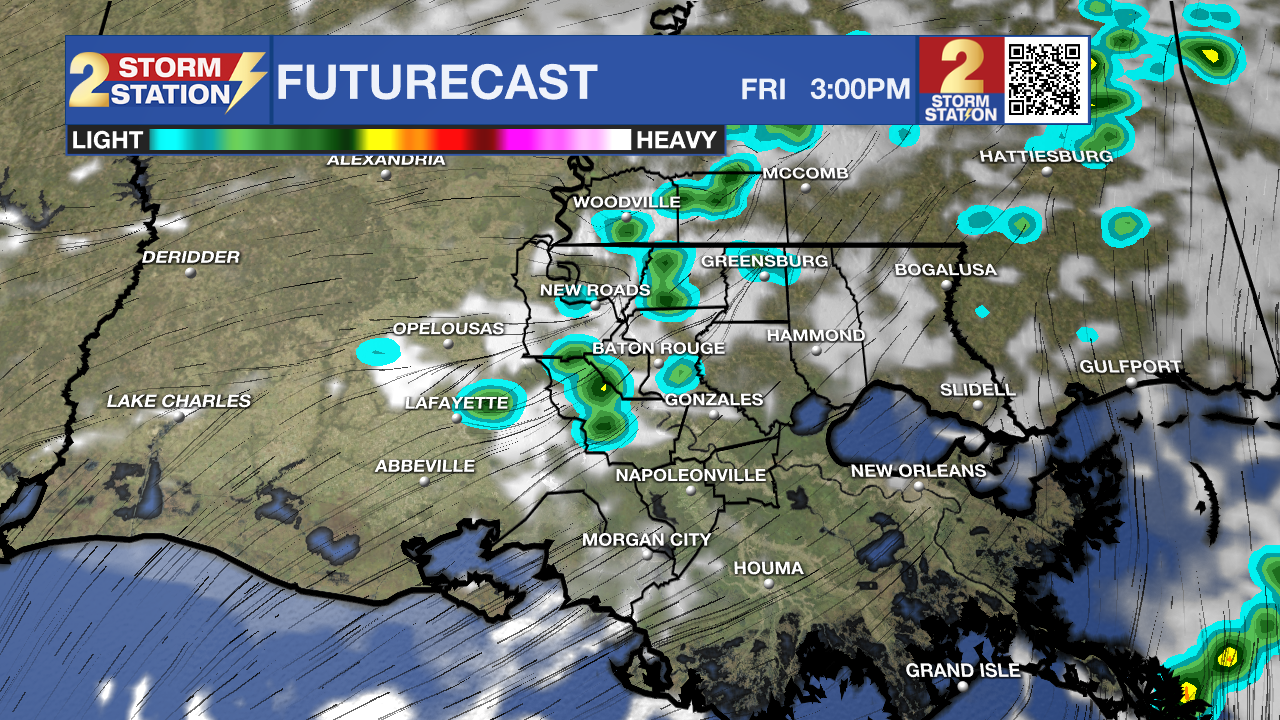
Up Next: With increasing clouds and an uptick in wind speeds on Thursday night, fog will be scarce early Friday. But the cloudiness will be the result of an approaching front from the northwest. As early as Friday morning and lasting into the day, that system will bring off-and-on showers to the region. Don’t expect an all-day washout, but have rain gear on hand; about 60% of the area will come across rain at some point or another. Showers will thin out in coverage through the evening, which is favorable for round two of the high school football playoffs and White Light Night in Mid-City. It will be warm and muggy with temperatures falling into the low 70s during the evening.
The front will fail to make a clean pass over the weekend, though it may enter the Capital Area and stall. The presence of a nearby front might spark an isolated shower or two on Saturday. Rain chances appear slightly lower on Sunday. The warmth will never get flushed out by the front, with highs remaining in the 80s with lows close to 60°. A separate storm system will move into the area next week, increasing rain chances again. Relatively cooler air will filter in on its backside, but it still won’t be a major cooldown — that won’t come until later in the week.
.png)
The Tropics: For the Gulf, Caribbean, and Atlantic, all is quiet. No new tropical development is expected over the next seven days.
Trending News
Get the latest 7-day forecast and real-time weather updates HERE.
Watch live news HERE.
— Meteorologist Malcolm Byron
The Storm Station is here for you, on every platform. Your weather updates can be found on News 2, wbrz.com, and the WBRZ WX App on your Apple or Android device. Follow WBRZ Weather on Facebook and X for even more weather updates while you are on the go.
More News
