

Latest Weather Blog
Friday morning video forecast
Related Story
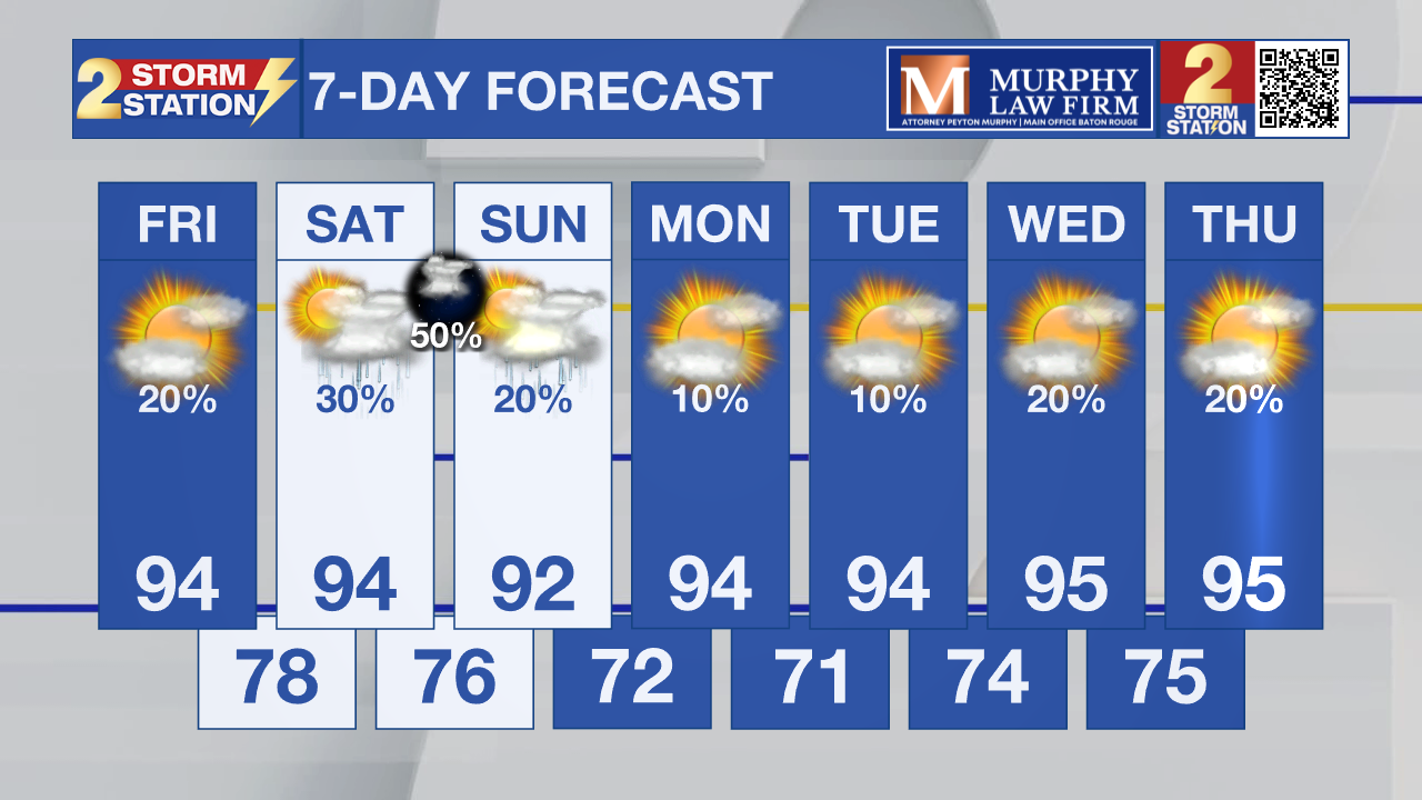
One more day of dangerous heat is expected across parts of southeast Louisiana before storm chances increase this weekend. A cold front could bring additional thunderstorms Saturday night and Sunday, with a few capable of damaging winds and heavy downpours.

Today and Tonight: A Heat Advisory is in effect from 11 a.m. until 7 p.m. for the southern half of the area, where heat index values could reach 110 degrees. Isolated afternoon storms are possible, mainly over eastern areas, while many areas west of Baton Rouge will stay hot and dry. Any storm that develops could briefly produce gusty winds.

Use the slider to advance through the next 24 hours of Futurecast
Up Next: Thunderstorm coverage increases Saturday as a cold front approaches from the north. A few storms could produce damaging wind gusts and heavy rainfall. Behind the front, humidity drops slightly with dew points falling, making it feel a bit less oppressive even though afternoon highs stay in the 90s.
Tropics: The tropics remain quiet, and the National Hurricane Center is not expecting any tropical cyclone development anywhere across the Atlantic Basin during the next seven days.
Get the latest 7-day forecast and real-time weather updates HERE.
Watch live news HERE.
– Dave
The Storm Station is here for you, on every platform. Your weather updates can be found on News 2, wbrz.com, and the WBRZ WX App on your Apple or Android device. Follow WBRZ Weather on Facebook and X for even more weather updates while you are on the go.
News

