

Latest Weather Blog
Tuesday Night Video Forecast
Related Story
Another wave of showers and thunderstorms will target the Capital Region late Wednesday, a few of which could be on the strong to severe side. A cold front follows close behind, clearing out the storms and setting up a crisp finish to the week.
Tonight & Tomorrow: Expect a partly cloudy evening with skies gradually thickening overnight. Another cloudy start is likely on Wednesday with very mild lows in the upper 60s to low 70s. The same warm and muggy feel will persist throughout Wednesday, pushing highs into the mid-80s despite the cloud cover. Much of the day will end up dry, but expect scattered showers and storms to begin firing by late afternoon. The coverage of rain and storms will grow into the evening as the next impact arrives.
The Next Impact: On Wednesday evening, a line of thunderstorms will roll through the Capital Region, likely arriving after dark. The line could push into Pointe Coupee and Iberville Parishes as early as 6 to 7 p.m., likely reaching Metro Baton Rouge in the 8 p.m. to midnight timeframe. Most of the action will clear the I-55 by 1 to 2 a.m. at the latest. Widespread rain is expected, with totals ranging from 1–2" in many neighborhoods. Fortunately, the quick-moving nature of these storms should limit flash flood concerns this time around; however, stay alert for brief, poor-drainage flooding in areas caught under the heaviest downpours.
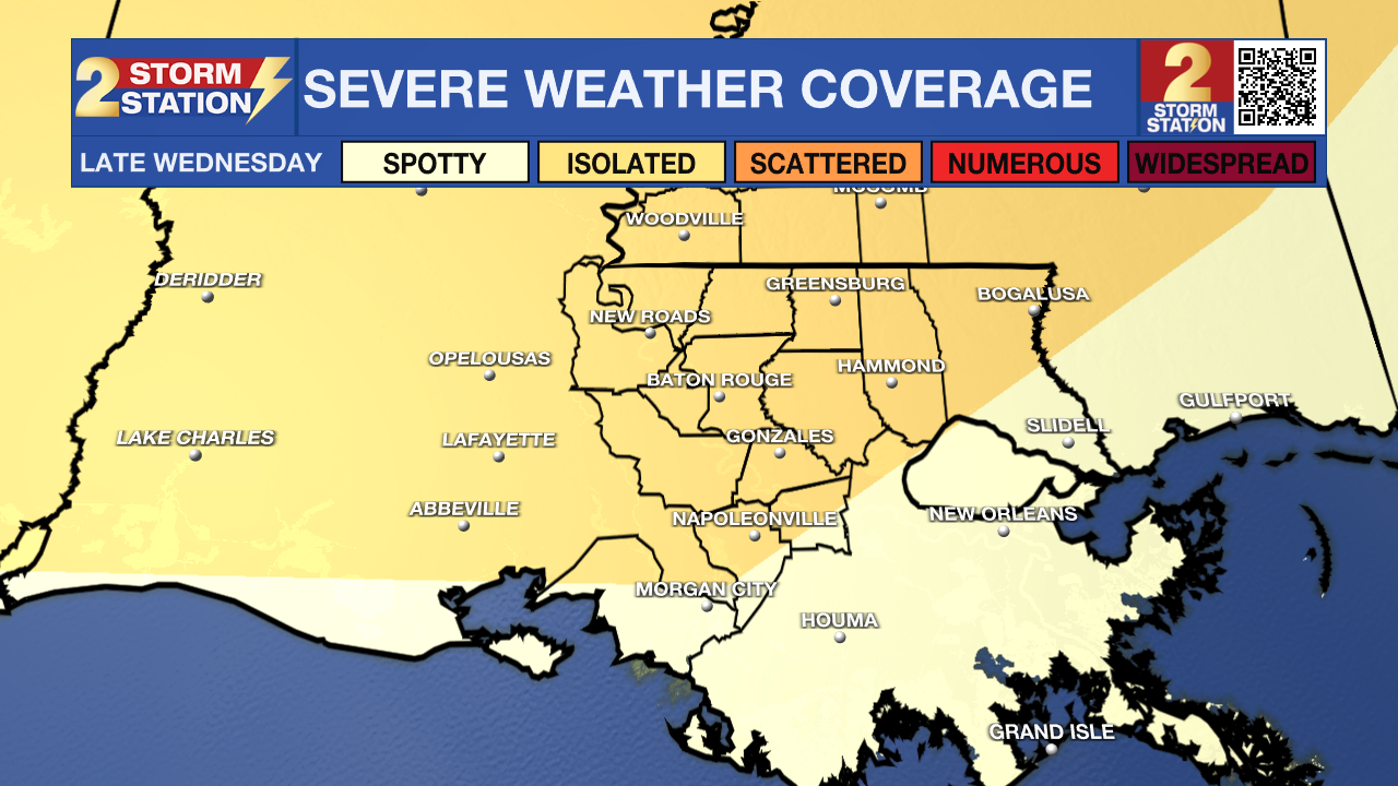
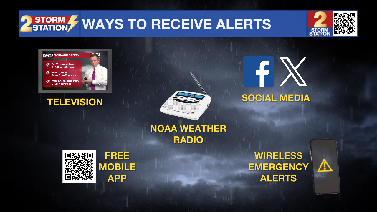
A few segments within Wednesday evening's line of storms may pack a punch. The Storm Prediction Center has placed most of the area under a Level 2/5 “Slight” risk for severe weather to address the isolated nature of any severe weather. Damaging straight-line winds exceeding 60 mph look to be the primary issue, though a few spin-up tornadoes cannot be ruled out. Keep phones charged and have a way to receive weather alerts, like the Storm Station Weather App, in case warnings are issued.

Up Next: A cold front will sweep the moisture out early Thursday, leaving sunshine to wrap up the week. More notably, a crisp air mass will follow the front, dropping highs into the 60s on Thursday and lows in the 40s on Friday. Another warmup will take place over the weekend, but it still looks comfortable with highs in the 80s and lows in the 50s — perfect for the Wearin’ of the Green parade on Saturday.
Another cold front will pass late Sunday, which will drop temperatures again early next week. This front could bring a more significant blast of chilly air, with 30s now showing up on the 7-Day Forecast for Tuesday morning. Those who have already planted their spring gardens will need to monitor the forecast closely.

Get the latest 7-day forecast and real-time weather updates HERE.
Watch live news HERE.
— Meteorologist Malcolm Byron
The Storm Station is here for you, on every platform. Your weather updates can be found on News 2, wbrz.com, and the WBRZ WX App on your Apple or Android device. Follow WBRZ Weather on Facebook and X for even more weather updates while you are on the go.
News
