

Latest Weather Blog
Friday AM Forecast: Cold front will cause big changes for Thanksgiving week
Temperatures will stay mild until a cold front passes Sunday and Monday. We will first see some showers and storms before a big cooldown for Thanksgiving week.

Today & Tonight: Expect partly sunny conditions throughout the day, with highs in the upper 70s. A few showers will be possible, but most will stay dry. If you're heading out to a high school football game, it’s going to feel noticeably milder than last week. Kickoff temperatures will be in the upper 60s and only cool down a few degrees by the final whistle, so a light pullover or long-sleeve shirt will do the trick. Later tonight, temperatures will settle back down into the upper 50s.
Trending News
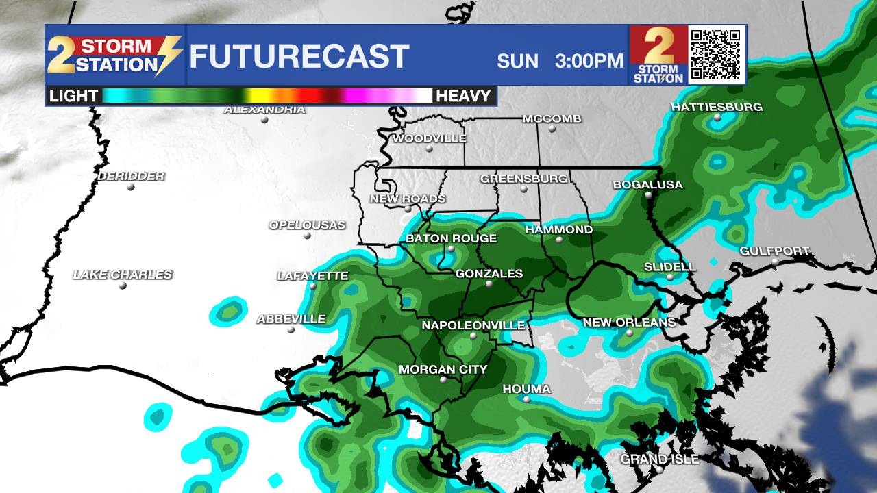
Use the slider to advance through the next 24 hours of Futurecast
Up Next: Saturday stays pretty quiet, featuring mostly cloudy skies, a slim 20% coverage for a stray sprinkle or light shower, and afternoon highs climbing into the upper 70s once again.
By Sunday, a weak cold front drops in from the north, bringing a few isolated showers and maybe a rumble of thunder. You'll still get plenty of dry time and warm highs in the mid-to-upper 70s, so outdoor plans are still a go!
Looking ahead to next week, the forecast gets a little complicated. The latest data shows a cold front passing late Sunday and early Monday, before moving offshore. This would dry things out enough to keep organized rain away Monday through Wednesday. Right now, that's the most probable scenario. On the flip side, if that front hangs up closer to the coast, an incoming system from the west could spark some rain during that same window, potentially causing headaches for holiday travelers. Either way, cooler air is moving in early next week, dropping highs into the 60s and lows into the 50s. Temperatures will keep trending downward from there, setting up a chilly Thanksgiving Day.
Get the latest 7-day forecast and real-time weather updates HERE.
Watch live news HERE.
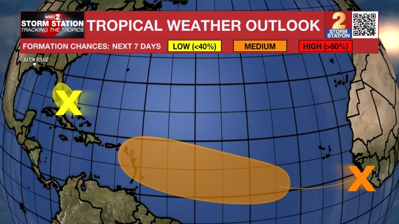
The Tropics: Surface observations indicate that a broad low pressure area has formed over southeastern Florida, the northwestern Bahamas, and the adjacent waters. The low is currently producing disorganized showers and thunderstorms extending from the central Florida peninsula
east-southeastward over the Atlantic. This system could acquire subtropical or tropical characteristics while it moves generally northward to north-northeastward near or just offshore of the southeastern United States coast through the weekend.
– Balin
The Storm Station is here for you, on every platform. Your weather updates can be found on News 2, wbrz.com, and the WBRZ WX App on your Apple or Android device. Follow WBRZ Weather on Facebook and X for even more weather updates while you are on the go.
More News

