

Latest Weather Blog
Friday AM Forecast: Weak front to elevate storm activity for first weekend of August
A weak front will bring more rain to start the first weekend of August. It won’t be a washout, but some afternoon plans could be briefly interrupted by passing downpours.
Today & Tonight: Friday will start sunny and warm, with highs in the low 90s. By midday, scattered showers and thunderstorms will begin to develop, influenced by ample moisture in the atmosphere plus a front moving in from the north. Expect hit-or-miss storms through the afternoon and evening, with some heavy rain or gusty winds possible. A few showers may linger overnight before skies turn partly cloudy. Temps dip to the mid-70s by Saturday morning.
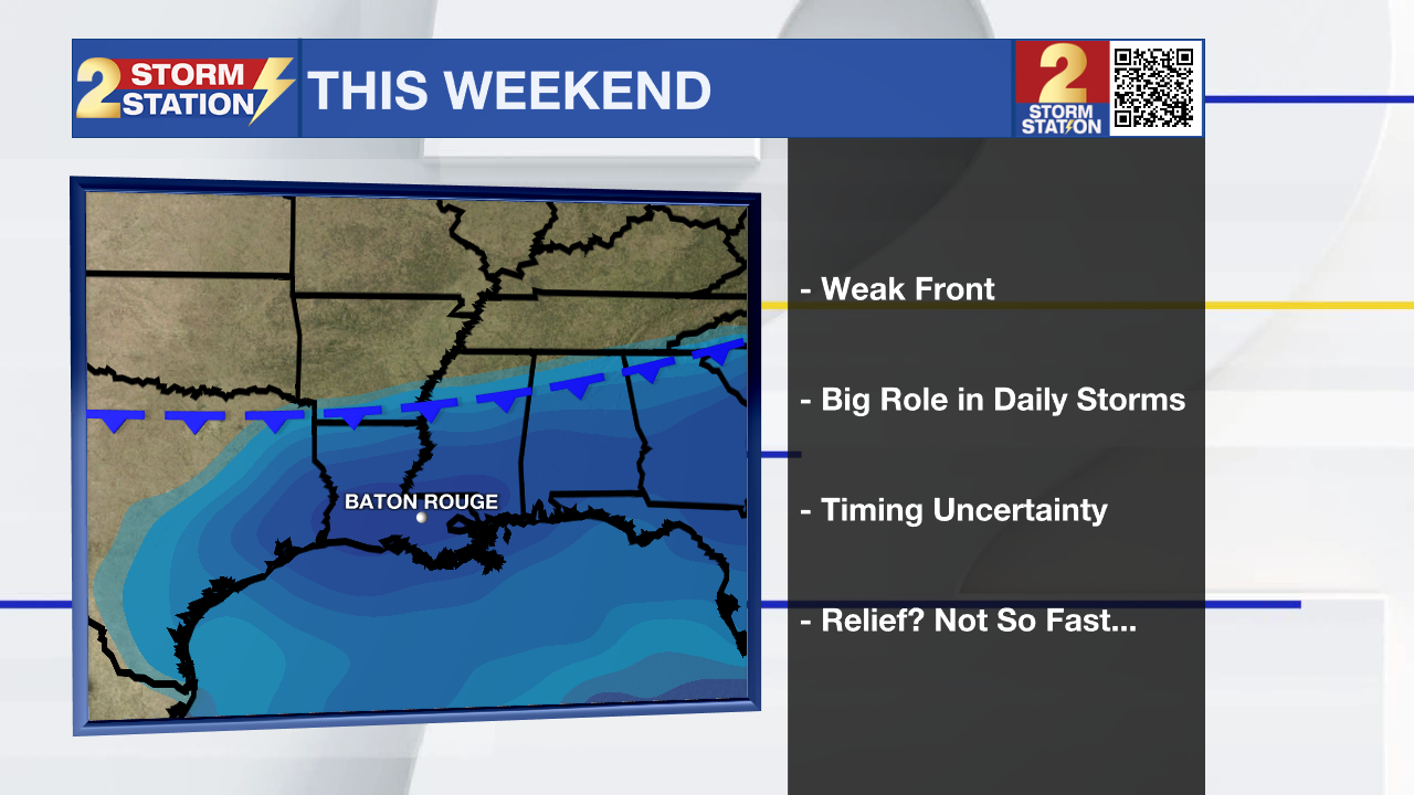
The Weekend: The same front will stick around and keep rain chances high on Saturday, especially in the afternoon and evening. Storms will be scattered but could be strong at times. Keep outdoor plans flexible. Storms can pop up quickly—if you hear thunder, head indoors. By Sunday, the front should shift south near the coast, drying things out a bit. That means lower rain chances and more sunshine to finish the weekend. Highs both days will be in the low 90s, with morning temps in the mid-70s.
Up Next: As school starts for many next week, expect a classic August weather pattern—sunny mornings, hot and humid afternoons, and isolated pop-up storms. Stay tuned for Back 2 School forecasts for each district on WBRZ next week!
The Tropics: For the Gulf, Caribbean, and North Atlantic, all is quiet. No tropical development is expected during the next 7 days.
Trending News
Get the latest 7-day forecast and real-time weather updates HERE.
Watch live news HERE.
– Emma Kate C.
The Storm Station is here for you, on every platform. Your weather updates can be found on News 2, wbrz.com, and the WBRZ WX App on your Apple or Android device. Follow WBRZ Weather on Facebook and X for even more weather updates while you are on the go.
More News
