

Latest Weather Blog
Gulf disturbance development chances increase, still poses minimal threat to Louisiana
The National Hurricane Center is monitoring a disturbance over the eastern Gulf near Florida that remains disorganized but could gradually develop over the coming days.
A broad surface low is forming over the eastern Gulf, but the associated winds remain light and showers and thunderstorms are still disorganized. The system is expected to move slowly northward or north-northwestward during the next few days.
The National Hurricane Center gives the system a 30 percent chance of forming within 48 hours and a 40 percent chance within 7 days. An Air Force Reserve reconnaissance aircraft is scheduled to investigate the system on Sunday, if needed.
The biggest concern, regardless of whether the system becomes a named storm, is the potential for several days of heavy rainfall and localized flooding across parts of Florida and the eastern Gulf Coast. The National Weather Service in Tallahassee noted that the chance for development has "crept upward" and that the area favorable for development has expanded westward, though tropical development is still far from certain.
Forecast trends have shifted slightly over the past couple of days. Earlier forecasts kept the disturbance closer to Florida, but more recent guidance has shifted the potential area of development slightly farther west into the eastern Gulf.
One reason for the uncertainty is that the system currently lacks a well-defined surface circulation. It is being driven primarily by an upper-level low and systems like this often struggle to organize into tropical cyclones.
Trending News

For Louisiana, current forecasts keep any potential tropical development focused much farther east near Florida. High pressure centered over the north-central Gulf continues to dominate the region's weather.
Depending on how close the system gets, moisture pulled in from it may help increase summertime storms and could give localized relief from the heat.
Deep moisture is expected to slowly edge into the area through mid-week, bringing a small increase of around 30 percent chance of rain.
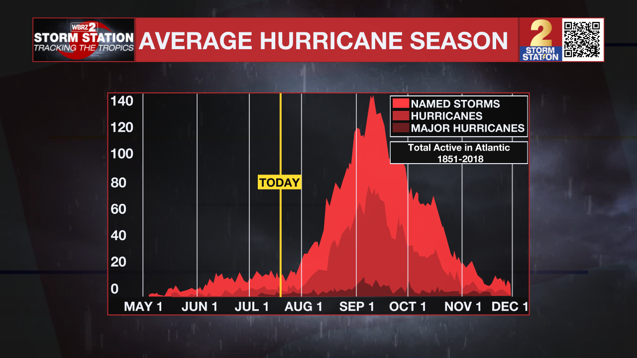
Historically, July has not been a particularly active month for Louisiana tropical landfalls. The most recent was Hurricane Barry in 2019, which made landfall near Intracoastal City before bringing flooding rain across much of south Louisiana. Before that, Hurricane Cindy moved ashore near southeastern Louisiana in early July 2005, bringing heavy rain and gusty winds to the New Orleans area.
Even when the tropics are quiet, this is the perfect time to make sure your hurricane plan is ready. Review your evacuation plans, check your emergency supplies, and make sure you have multiple ways to receive weather alerts. Waiting until a storm is approaching Louisiana is never the best time to prepare.
The Storm Station is here for you, on every platform. Your weather updates can be found on News 2, wbrz.com, and the WBRZ WX App on your Apple or Android device. Follow WBRZ Weather on Facebook and X for even more weather updates while you are on the go.
More News

