

Latest Weather Blog
Monday AM Forecast: Muggy start to week, Cold front Tuesday brings significant cool down
Temperatures remain above average to start the week until a strong cold front arrives Tuesday, brining back the "fall feels" to both the mornings and afternoons!
Today & Tonight: A few patchy areas of fog may accompany the early Monday morning commute as moisture creeps back into southern Louisiana. The uptick in moisture also means a slightly sticky feel to the air and a warmer start to the day; temperatures early Monday will start off in the mid/upper-60s under mainly clear skies. Once the sun rises in the 7 o'clock hour, any fog will burn off and temperatures will begin heating. Afternoon conditions will be warm and muggy with highs near 90 degrees. Overnight, temperatures will cool into the mid-60s as a cold front approaches the area.
For those hoping to see the rare astronomical sight again tonight, skies will remain mostly clear around sunset which will make for optimal viewing of Comet C/2023 A3. More details about the comet can be found here.
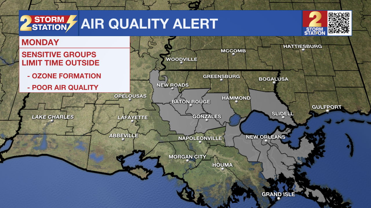
An Air Quality Alert has also been issued for the metro regions of Baton Rouge and New Orleans Monday. Warm temperatures, light winds, and abundant sunshine could lead to ozone formation. Concentrations could rise to levels unhealthy for those with breathing sensitivities, especially during the afternoon.
Up Next: A cold front that will approach the area Monday night will stall over Louisiana on Tuesday before finally pushing south towards the Gulf late Tuesday evening. Depending on how slow or fast this front moves will determine how warm temperatures will get Tuesday afternoon. As of now, data suggests another warm day on Tuesday before much cooler air arrives for the remainder of the week.
Trending News
By Wednesday morning, jackets will be needed as temperatures begin in the low-50s and warm into the mid-70s under mainly sunny skies. Thursday morning will be the coolest of the week, with Baton Rouge likely to record a morning low in the 40s for the first time in months! The nice fall like conditions will continue into weekend as well. While the cool air will be a nice treat, the cold front will also continue the stretch of dry days. No chance of rain can be found on the Storm Station 7-day forecast.
Get the latest 7-day forecast and real time weather updates HERE.
Watch live news HERE.
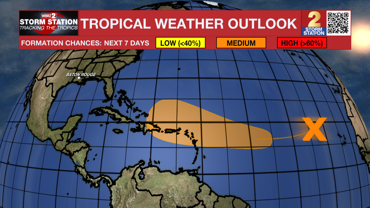
The Tropics: A well-defined area of low pressure located several hundred miles west of the Cabo Verde Islands is producing minimal showers and thunderstorms. This system is currently embedded in an unfavorable environment and development is not anticipated over the next couple of days. However, this system is forecast to move generally westward to west-southwestward, and environmental conditions could become more favorable for gradual development by the middle to latter part of this week. A tropical depression could form as the system begins moving west-northwestward and approaches or moves near the Leeward Islands by the end of this week.
- Emma Kate C.
The Storm Station is here for you, on every platform. Your weather updates can be found on News 2, wbrz.com, and the WBRZ WX App on your Apple or Android device. Follow WBRZ Weather on Facebook and Twitter for even more weather updates while you are on the go.
More News
