

Latest Weather Blog
Monday PM Forecast: Heat continues to stack up, storms offering occasional relief
The heat shows no signs of letting up as the new workweek begins. Very warm mornings will continue to transition into scorching afternoons. There is a slightly better chance of catching a hit-or-miss thunderstorm, but that doesn’t mean the heat will disappear.
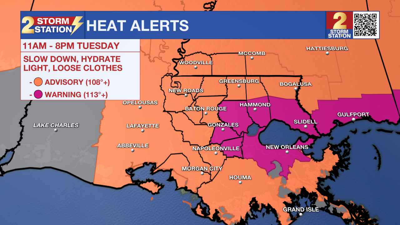
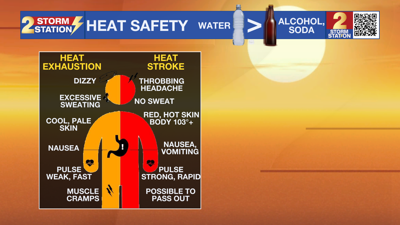
A Heat Advisory will be in effect for most of the Capital Area from 11 a.m. to 8 p.m. Tuesday. However, Ascension, Livingston, St. James, and lower Tangipahoa Parishes will fall under an Extreme Heat Warning. Expect peak heat index values above 108° across the entire region, with warning areas potentially topping 113°. Take frequent breaks in the shade, stay well-hydrated, and watch for signs of heat exhaustion if outdoors for a prolonged period.
Now that the intense heat has been ongoing for several days, keep in mind that the effects of it stack up over time. As it continues, consider checking in with friends, neighbors, and family — especially young kids, the elderly, and anyone without access to A/C.
Tonight & Tomorrow: Afternoon storms will wrap up quickly heading into the evening. Expect clearing skies overnight, though temperatures will stay warm in the 80s for most of the night. Morning lows will settle in the upper 70s, with Baton Rouge potentially matching its record-warmest low of 78°.
The warm start will give way to a hot finish as high temperatures reach the upper 90s once again on Tuesday. Relentless humidity will drive heat index values near 110° across most areas, reaching up to 115° near rivers and the tidal lakes. Once the heat reaches a peak, afternoon storms may try to bring some relief, but don't count on rain everywhere. Activity will stay scattered, with about 30% of the area catching a shower. However, any storms that do develop could bring heavy rain and gusty winds.

Trending News
Up Next: Heat will continue to dominate for the rest of the week. By continuing the streak of upper 90s and keeping the humidity, additional heat alerts are likely at least through midweek. Isolated afternoon storms could cool off a few lucky spots, but relief won't be widespread. Expect most of this storm activity to build after intense heat peaks, and it won’t be an everyday occurrence. Night won’t offer much relief either, with the steamy feel and lows in the mid-to-upper 70s making it harder to cool off — especially for those without access to A/C.
Get the latest 7-day forecast and real-time weather updates HERE.
Watch live news HERE.
The Tropics: No tropical development is expected over the next seven days across the North Atlantic, Gulf, and Caribbean.
— Meteorologist Malcolm Byron
The Storm Station is here for you, on every platform. Your weather updates can be found on News 2, wbrz.com, and the WBRZ WX App on your Apple or Android device. Follow WBRZ Weather on Facebook and X for even more weather updates while you are on the go.
More News

