

Latest Weather Blog
NEW: A Severe Thunderstorm Watch has been issued for Baton Rouge and areas north
The National Weather Service has issued a Severe Thunderstorm Watch for East Baton Rouge, West Baton Rouge, East Feliciana, Livingston, Pointe Coupee, St. Helena, Tangipahoa, and West Feliciana Parishes, as well as Amite and Wilkinson Counties until 9 p.m. Wednesday.
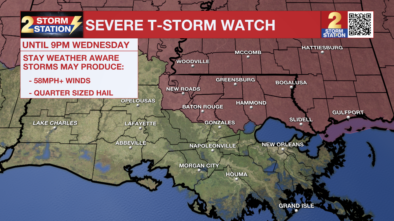
A SEVERE THUNDERSTORM WATCH means conditions are favorable for damaging winds and/or large hail in and around the watch area. Be on the lookout for threatening weather conditions and listen for later statements and possible warnings. If a Severe Thunderstorm Warning is issued, shelter in a sturdy, enclosed building. Ensure your pets have adequate shelter, and try to avoid covered decks, large rooms, and sheds. For more on severe thunderstorm safety, CLICK HERE.
Storm clusters are forecast to intensify as they approach the Louisiana-Mississippi state line, likely arriving as early as 4 to 6 p.m. By nightfall, these storms could push as far south as the I-10/12 corridor. The most severe cells will be capable of producing large hail, damaging wind gusts of 55–70 mph, and the potential for a brief spin-up tornado.

Trending News
Remember that the Storm Station Weather App is *free* on Apple and Android devices and can be used for breaking weather information, live radar, and forecast details. You can also use it to watch live coverage if the power or broadcast signal is ever lost. For even more, connect with the Storm Station on X and Facebook. Stream WBRZ+ for continuous information as it becomes available.
More News
