

Latest Weather Blog
Saturday AM forecast: Great parade weather. Sunday's front brings storms and a winter chill
Warm and Sunny for Wearin’ of the Green Parade. A Strong Cold Front Brings Storms Sunday Night Before Much Colder Air Next Week.

Today and tonight: Saturday will be a beautiful day across the Capital Region with mostly sunny skies and temperatures climbing into the upper 70s during the afternoon. Humidity will gradually increase through the day as southerly winds return ahead of the next cold front.
Conditions will be especially nice for the Wearin’ of the Green Parade. Expect sunshine mixed with a few clouds with temperatures rising from the mid-70s to near 80. Winds will be light to moderate out of the southeast, and no rain is expected during the parade.
Saturday night will be mild with lows only dropping into the upper 50s and lower 60s as clouds begin to increase ahead of the next weather system.
Trending News
Up Next: Sunday will be even warmer with highs climbing into the lower 80s across the Capital Region. Skies will become partly to mostly cloudy as moisture continues to increase ahead of an approaching cold front.

Use the slider to advance through the next 24 hours of Futurecast
Late Sunday night into early Monday morning, a line of showers and thunderstorms will move through the region as the front sweeps across Louisiana. A few storms could become strong with gusty winds, especially north of the I-10/12 corridor. Northern areas are under a Level 2 Slight Risk, while southern areas are in the Level 1 Marginal risk according to the Storm Prediction Center.
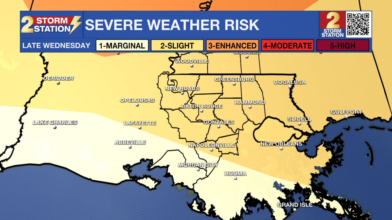
What to look out for: The main weather concern arrives late Sunday night when a strong cold front moves through the region. A fast-moving line of storms may develop along the boundary with the potential for damaging wind gusts and isolated brief tornado spin-ups.
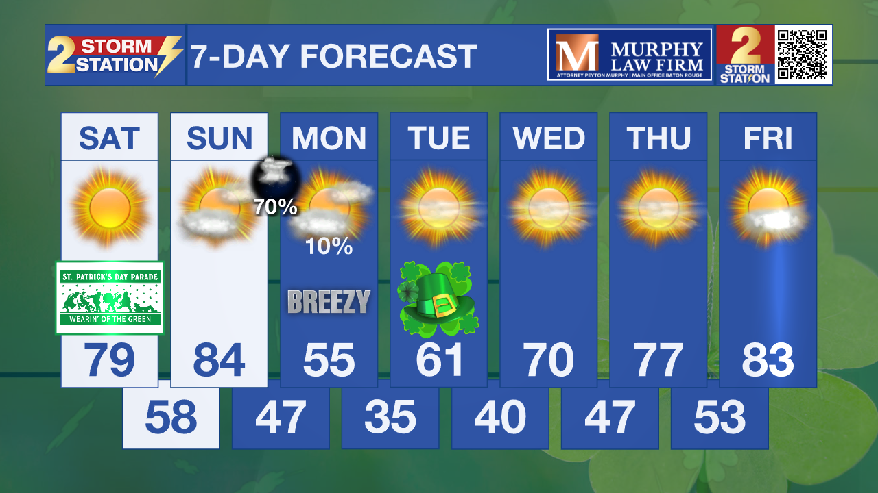
Behind the front, much colder air will move in quickly. Highs on Monday will only reach the 50s, with gusty winds, and temperatures could drop into the 30s Monday night with frost possible in some areas north of Interstate 10.
Get the latest 7-day forecast and real-time weather updates HERE.
Watch live news HERE.
– Dave
The Storm Station is here for you, on every platform. Your weather updates can be found on News 2, wbrz.com, and the WBRZ WX App on your Apple or Android device. Follow WBRZ Weather on Facebook and X for even more weather updates while you are on the go.
More News
