

Latest Weather Blog
Sunday AM Forecast: Morning Rain Moves Out, More Comfortable Air Arrives
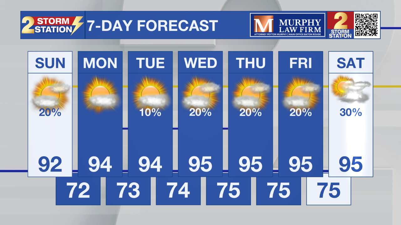
The last of this morning's showers is pushing south of the Baton Rouge area, with drier air quickly moving in behind a weak front. Sunshine returns this afternoon, and while temperatures will still reach the lower to middle 90s, the lower humidity will make it feel much more comfortable than it has in recent days.

Today and Tonight: Rain will continue ending from north to south this morning, with most of the Capital Region dry by mid-morning. The best chance for lingering showers will remain closer to the coast. This afternoon turns mostly sunny with lower humidity, and tonight will be mostly clear, warm, and noticeably less muggy.

Use the slider to advance through the next 24 hours of Futurecast
Up Next: Monday through Wednesday look mostly dry across the Baton Rouge area with only a very isolated afternoon shower returning by Tuesday. Humidity stays lower through midweek before Gulf moisture gradually returns late in the week, bringing back scattered afternoon thunderstorms along with hotter, more humid conditions by Thursday and Friday.
Trending News
Tropics: The Atlantic Basin remains quiet. The National Hurricane Center is not expecting tropical development during the next seven days.
Get the latest 7-day forecast and real-time weather updates HERE.
Watch live news HERE.
– Dave
The Storm Station is here for you, on every platform. Your weather updates can be found on News 2, wbrz.com, and the WBRZ WX App on your Apple or Android device. Follow WBRZ Weather on Facebook and X for even more weather updates while you are on the go.
More News

