

Latest Weather Blog
Sunday AM Forecast: Numerous showers and storms Monday morning
Clouds are increasing in coverage throughout the area, as moisture content continues to increase. These clouds will eventually turn into showers and thunderstorms Monday morning.
Today & Tonight: Changes are underway, as moisture content in the atmosphere steadily rises. For today, that will mean mostly cloudy conditions, and some isolated light showers. Temperatures will be warm once again, near 80 degrees. It will also be a breezy day, with winds out of the south at 10-20 mph. Clouds will thicken even more as we head into the overnight hours. A cold front will be approaching the area, and eventually spark a lot of showers and thunderstorms. Latest trends has pointed to this mainly being a Monday problem, with most of the overnight hours dry. Lows will be in the mid 60's.
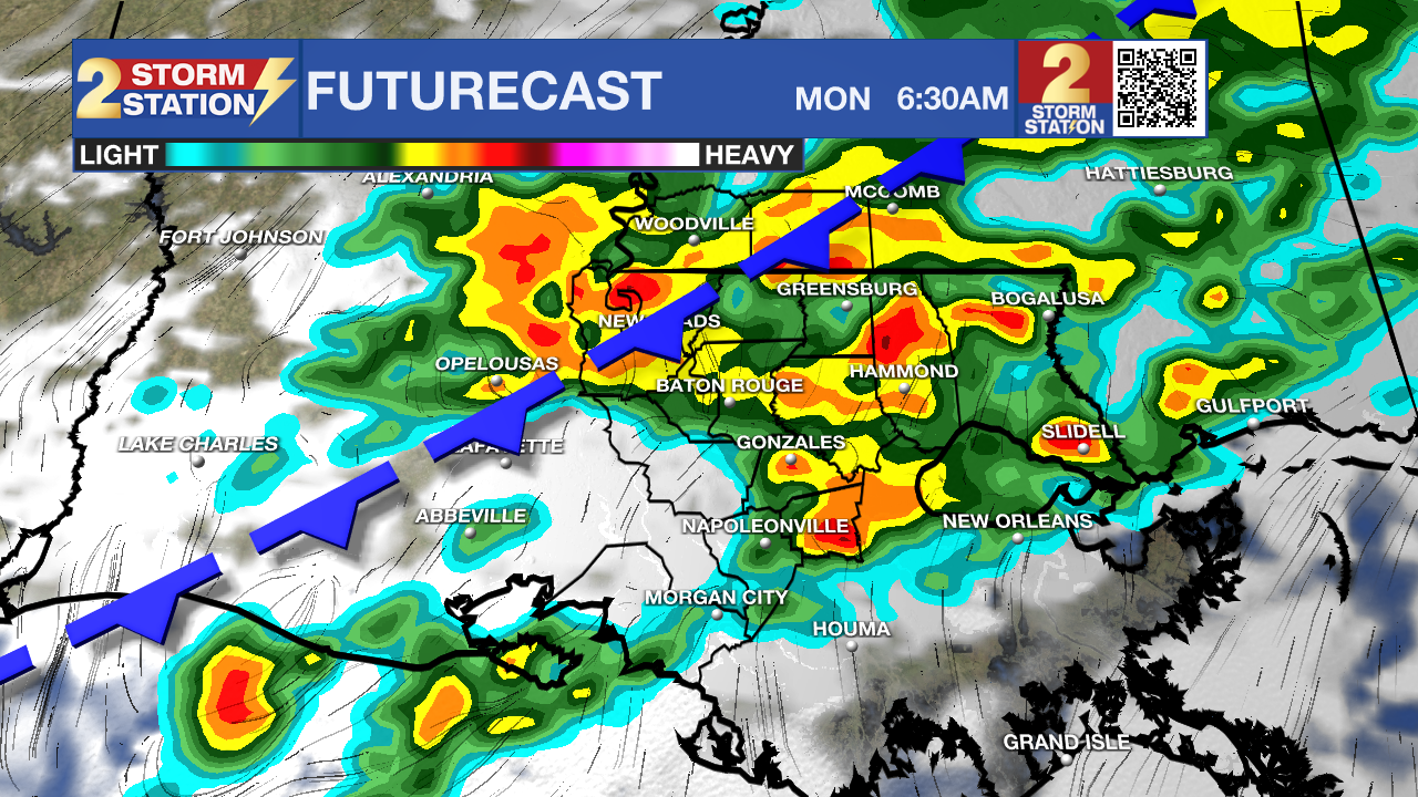
The Next Rainmaker: Showers and thunderstorms will enter from the north on Monday morning as a weak cold front sweeps through the area. We could first start to see this activity by 4-5am with the most likely time for storms during the peak commute hours. As you can imagine, this could create a mess of things, so plan on leaving a bit earlier than normal. Rain coverage should drastically go down by the afternoon as the front stalls near the coast. Still, some isolated showers will be possible in the afternoon and evening. As for severe weather, the threat is low, but not impossible. A level 1/5 risk has been posted for the entire area. 1-2 stronger storms are the expectation, but with these low risk, it would not be surprising if every storm stayed below severe limits. Hail and gusty winds will be the main concerns if a storm were to go severe. There is a very low-end chance of a brief spin-up tornado as well. In total, most should see a half an inch, to an inch of rain. Isolated higher totals will be possible, especially in thunderstorms.
Up Next: In general, the weather should quiet down once again through mid-week. The previously mentioned front should slowly decay as it sits near the coast. All week long it will be warm, with highs in the 80s, which is a good bit above average for this time of year. Our next best shot at rain will arrive late week into the weekend.
Trending News
Get the latest 7-day forecast and real-time weather updates HERE.
Watch live news HERE.
– Balin
The Storm Station is here for you, on every platform. Your weather updates can be found on News 2, wbrz.com, and the WBRZ WX App on your Apple or Android device. Follow WBRZ Weather on Facebook and X for even more weather updates while you are on the go.
More News
