

Latest Weather Blog
Sunday PM Forecast: Front splitting the region, intermittent spells of drier air
Slim rain chances and near-normal temperatures are a common theme on the Storm Station 7-Day Forecast. But a stalled front will keep things interesting by offering an extended humidity break to some.
Tonight & Tomorrow: A stalled front will keep a pocket of drier air in place overnight. Overnight lows will differ from one side of the front to the other. North of the boundary, drier air allows temperatures to dip into the low 70s, with some spots slipping into the upper 60s. South of the front, added humidity will keep readings closer to the mid-70s. Skies stay mainly clear for all. Sunshine will dominate into Monday. The late-August sun will push thermometers into the mid-90s. Though still hot, slightly lower humidity will make it more tolerable near and north of Metro Baton Rouge. However, coastal and marshy areas may find less relief with the humid feel holding firm. Higher up in the atmosphere, it will be bone-dry everywhere. That will result in little to possibly no rain during the afternoon.
Up Next: The previously mentioned front will hang out in the area through the rest of the week, dividing humid air from a slightly less steamy feel. Subtle shifts in the front’s position will result in changes in who sees what from day to day. Southern areas have a higher chance of keeping the humidity, whereas northern sections are more likely to benefit from a nose of dry air on a given day. Overnight lows will be tied to the humidity level — less steam means cooler overnight lows. But in general, highs will be close to average in the low to mid 90s. Near to slightly below-average lows are expected, in the upper 60s to lower 70s. As for rain, it won’t be plentiful. Stray showers will be the exception as opposed to the rule through Thursday. There’s a slightly better shot at coming across an isolated storm by late week.
The Tropics: Tropical Storm Fernand strengthened slightly while moving through the subtropical Atlantic on Sunday. Further strengthening is possible over the next day or so, but the storm will become post-tropical by midweek. Fernand will pose no threat to land.
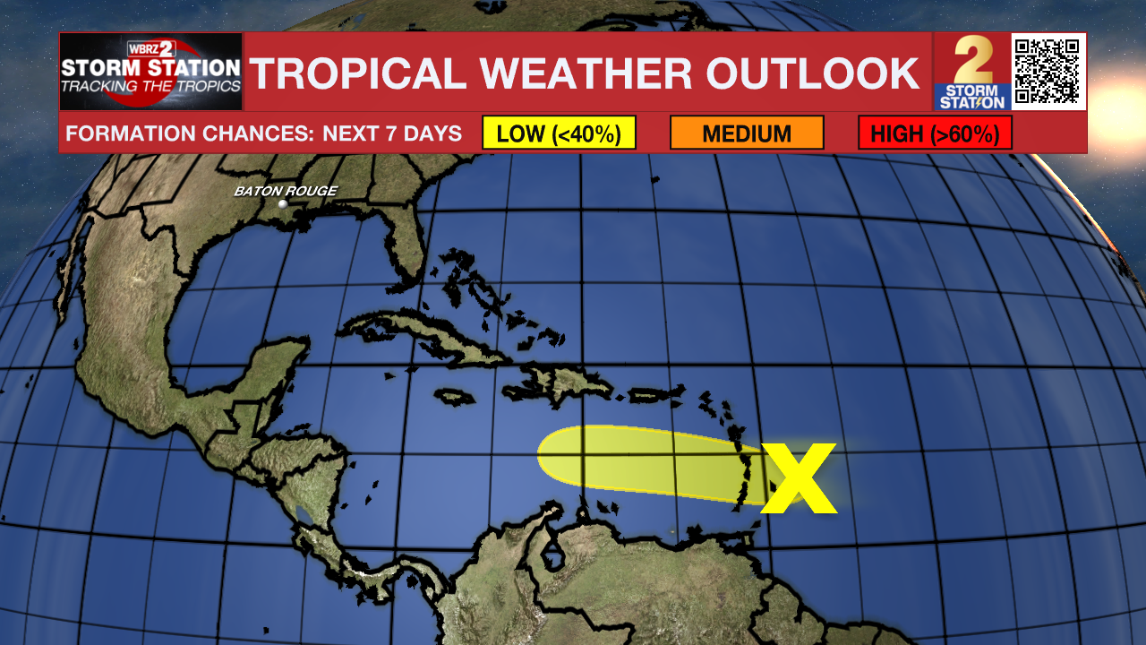
Meanwhile, a disturbance producing a large area of showers and thunderstorms is approaching the Lesser Antilles. The system did not have a closed low-level circulation per Air Force Reserve Hurricane Hunter reconnaissance data on Sunday afternoon. As a result, tropical development odds appear rather low with this system. Conditions are forecast to become even more hostile as the system moves through the Caribbean in the coming days.
Trending News
Get the latest 7-day forecast and real-time weather updates HERE.
Watch live news HERE.
— Meteorologist Malcolm Byron
The Storm Station is here for you, on every platform. Your weather updates can be found on News 2, wbrz.com, and the WBRZ WX App on your Apple or Android device. Follow WBRZ Weather on Facebook and X for even more weather updates while you are on the go.
More News
