

Latest Weather Blog
Tuesday AM forecast: Storm Chances Increase as Pattern Finally Starts to Shift
Our weather pattern is showing a little more movement as we head toward the end of the week. While the heat remains firmly in place, a stronger upper-level trough moving by could help bring more storms into the forecast by the end of the week.

Today and Tonight: Tuesday will be another hot and humid day, with heat index values commonly reaching 108 to 115 degrees. An Extreme Heat Warning is in effect near the lakes, with a Heat Advisory elsewhere, including metro Baton Rouge.
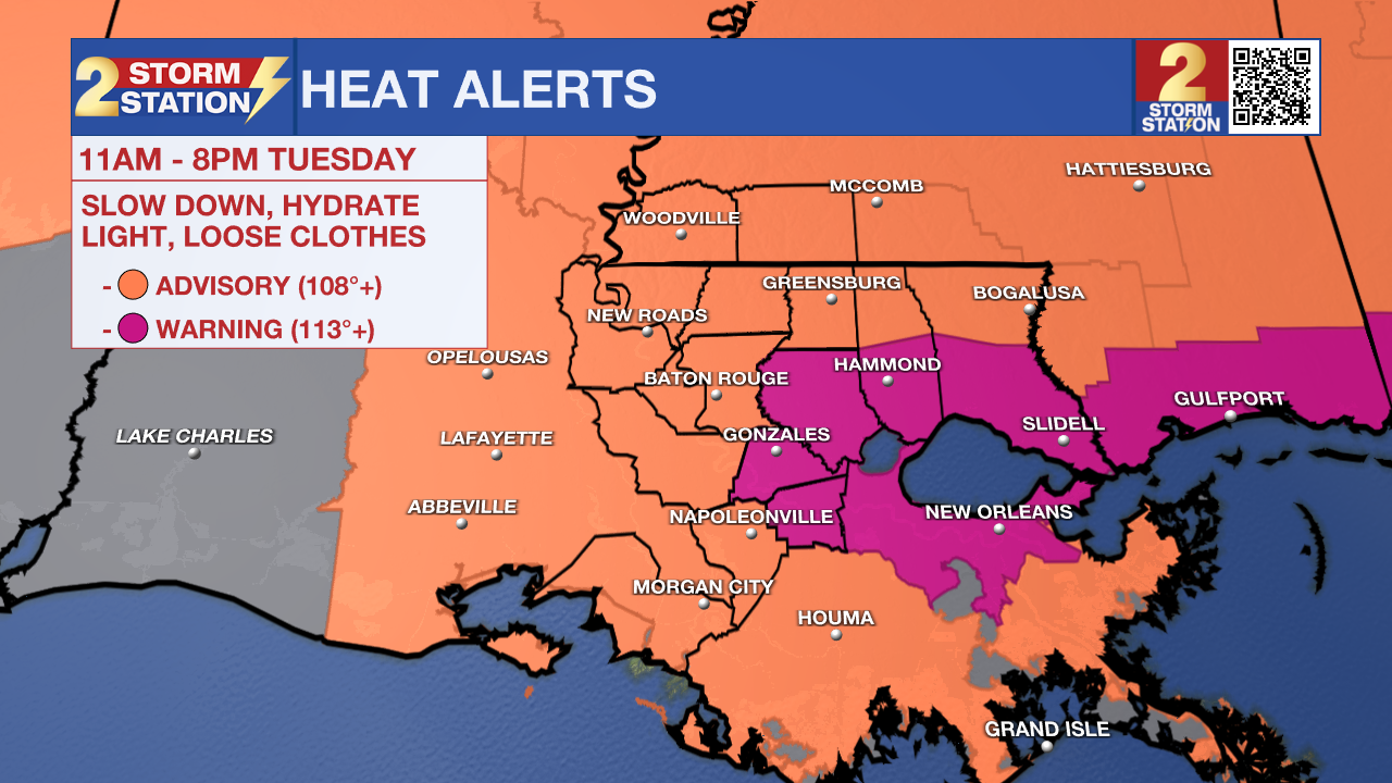
Only isolated thunderstorms are expected late afternoon. Storms will be more likely toward the lakes area and southwest Mississippi, while Baton Rouge and areas farther west could see fewer storms. Any storm that develops could produce strong wind gusts and heavy rain.
Trending News

Use the slider to advance through the next 24 hours of Futurecast
Up Next: Storm coverage should gradually increase through the week as the upper-level pattern becomes more favorable for thunderstorms. By Friday, a stronger trough digging into the central and eastern U.S. will help a front get closer to the region, bringing the best chance for storms this week.
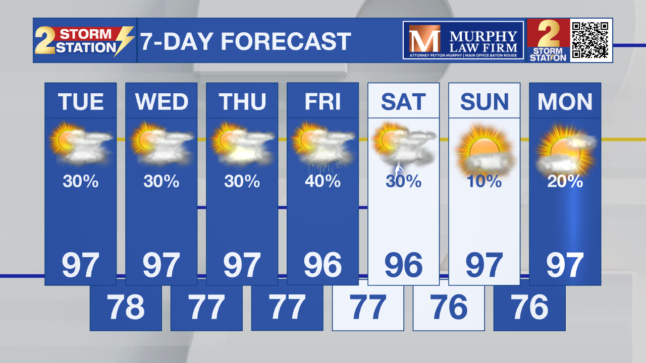
The weekend then takes on a slightly different look. Drier air filtering into the region should lower moisture values somewhat, but highs will still reach the mid and upper 90s. Storms will become more spotty, although a completely dry weekend isn't expected.

Tropics: The tropics remain quiet, with the National Hurricane Center not expecting tropical development in the Atlantic Basin during the next seven days.
Get the latest 7-day forecast and real-time weather updates HERE.
Watch live news HERE.
– Dave
The Storm Station is here for you, on every platform. Your weather updates can be found on News 2, wbrz.com, and the WBRZ WX App on your Apple or Android device. Follow WBRZ Weather on Facebook and X for even more weather updates while you are on the go.
More News

