

Latest Weather Blog
Wednesday AM Forecast: Days with lower humidity are numbered, rain chances rise soon
Humidity will gradually rise for the rest of the week, effectively ending the more comfortable conditions. This uptick in moisture will eventually lead to more showers and storms.
Today & Tonight: Lower available moisture staying in place will lead to mostly sunny skies, and very few afternoon showers. Highs will reach into the lower 90s, with a heat index staying below the triple digits. Skies will stay mostly clear in the overnight hours, with lows in the lower 70s.
Up Next: Winds will flip back out of the south Thursday, allowing higher moisture values to move into the region. This will cause a few more clouds, and greater humidity values. Temperatures will climb into the low to mid-90s, but the chance for rain stays slim—just a brief, stray shower possible mainly south of I-10. By Friday, available moisture increases even more, as a disturbance and front slides down from the northwest. Scattered showers and thunderstorms will be the result, so keep this in mind if you have plans.
Looking towards the weekend, another weak front may drift into or even through the Capital Area, but the exact setup is still uncertain. Because of that, the rain forecast is a bit tricky. At this point, only spotty to isolated showers and storms are expected. However, rain chances could tick upward if the boundary stalls overhead, or trend lower if it pushes offshore. Check back with the Storm Station as the picture becomes clearer.
Early next week, humidity looks to ease once again, with a slight dip in temperatures also possible. Weather disruptions around Labor Day appear unlikely.
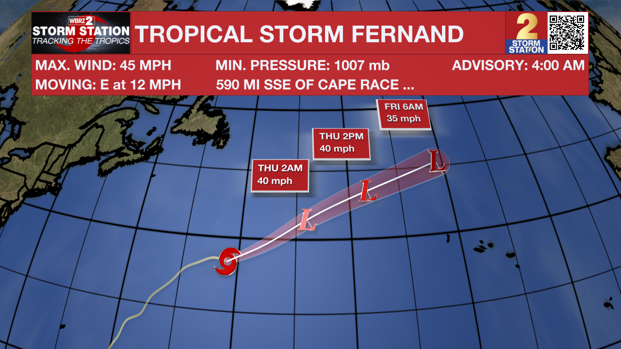
The Tropics: Tropical Storm Fernand is weakening over the open Atlantic, and will become post-tropical tonight. As of Wednesday morning, Fernand was located about 590 miles SSE of Cape Race, Newfoundland, moving east at 12 mph. The storm is producing maximum sustained winds of 45 mph.
Trending News
No additional tropical development is expected over the next seven days. The rest of the Gulf, Caribbean, and Atlantic are quiet.
Get the latest 7-day forecast and real-time weather updates HERE.
Watch live news HERE.
– Balin
The Storm Station is here for you, on every platform. Your weather updates can be found on News 2, wbrz.com, and the WBRZ WX App on your Apple or Android device. Follow WBRZ Weather on Facebook and X for even more weather updates while you are on the go.
More News
