Wednesday PM Forecast: astronomical summer to end on a heat streak
The end of astronomical summer will feel every bit like we’re still in the heart of the season. Expect high and low temperatures to run about 5 degrees above average through the weekend.
Tonight & Tomorrow: If you were under one of the few spotty showers that developed on Wednesday, they will diminish after nightfall. Beneath a clearing sky, low temperatures will fall to the low 70s. Some patchy fog may develop near dawn. Just beware of that on the morning drive and use low beam headlights if any is encountered while driving. Thursday will be hot and humid. With a mix of sun and clouds, high temperatures will jump into the low 90s.
Up Next: Despite rain chances drying up, it will still feel tropical during the final days of astronomical summer. In fact, with ongoing humidity, highs could be pushing the mid 90s with feels-like temperatures approaching 100 degrees Friday through the weekend. Skies will be mainly clear. Early on, it is looking rather toasty on Saturday afternoon in Tiger Stadium as LSU hosts UCLA. According to the LSU Kickoff Weather Index, the kickoff temperature will be one of the top three hottest on record. Into next week, there are a number of factors that will play into the forecast including a weak front approaching from the northwest and the possibility of a tropical system in the southeastern Gulf of Mexico. Any added impacts such as rain will likely not be in play until Tuesday or Wednesday.
Get the latest 7-day forecast and real time weather updates HERE.
Watch live news HERE.
Trending News
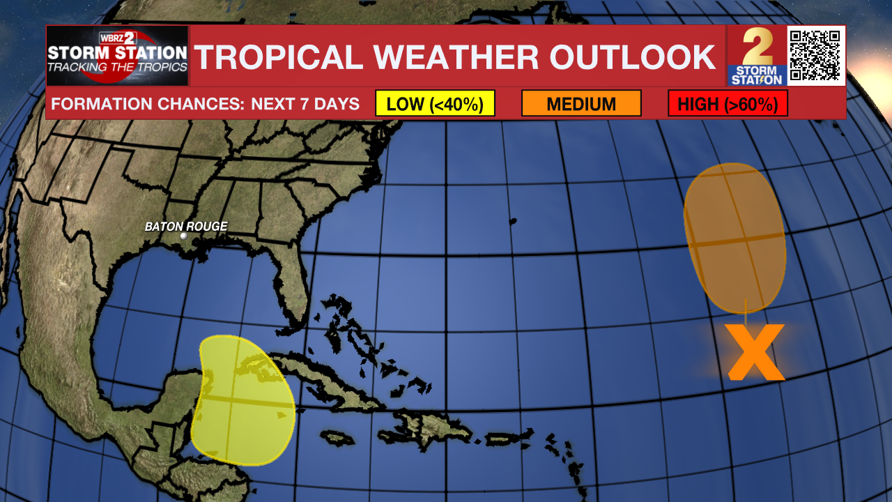
The Tropics: An area of disorganized showers and thunderstorms located over the central tropical Atlantic is associated with the remnants of Gordon. This system is forecast to interact with a non-tropical low to its northwest while moving north-northeastward at 5 to 10 mph during the next couple of days. Environmental conditions could become more conducive for development later this week, and a tropical depression or storm could re-form in a few days while the system moves slowly northward over the central subtropical Atlantic.

A broad area of low pressure could form late this weekend or early next week over the northwestern Caribbean Sea. Thereafter, some slow development of this system is possible through the middle of next week while it moves slowly to the north or northwest over the northwestern Caribbean Sea or the southeastern Gulf of Mexico.
– Josh
The Storm Station is here for you, on every platform. Your weather updates can be found on News 2, wbrz.com, and the WBRZ WX App on your Apple or Android device. Follow WBRZ Weather on Facebook and Twitter for even more weather updates while you are on the go.


