Wednesday PM Forecast: soaking rain expected to end workweek
Another soaking rain event is right around the corner, bringing messy commutes and making outdoor plans difficult. Overall, 1–3” of rain is expected, with locally higher amounts in narrow corridors.

Tonight & Tomorrow: Clouds will thicken through the evening as temperatures bottom out in the upper 40s. Rain will be minimal before midnight, but the coverage will ramp up overnight. Widespread rain, possibly heavy at times, is likely for the morning commute. Major flash flooding is not expected since rain will generally fall over a longer period; however, downpours could cause street and poor drainage flooding in select areas. Prepare for slick roads, anticipate travel delays, and keep a close eye on weather alerts on the Storm Station Weather App. While there might be some dry moments after the morning, off-and-on showers will still be likely. Look for wet roads even during the commute home, with showers possibly contributing to additional delays. Temperature-wise, they won’t move much. It will feel damp and cool with a high in the low to mid-50s.

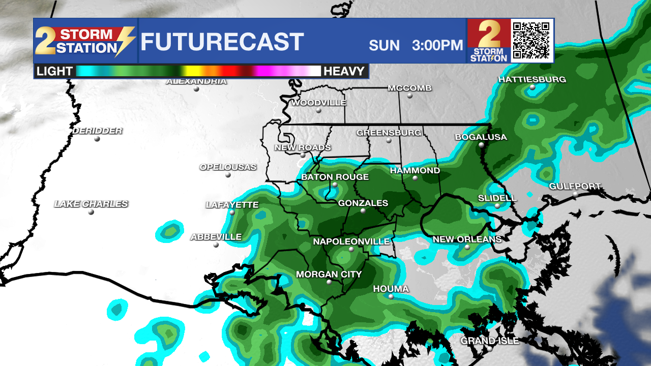
Use the slider to advance through the next 24 hours of Futurecast
Trending News
More Rain to Follow: Periods of rain will continue through the rest of the week, while still feeling damp and cool. Numerous showers are expected on Friday, with their off-and-on nature making it difficult to find prolonged dry time outside. Rain might even linger on Saturday — a new development to the Storm Station forecast. Saturday doesn’t look like a washout, but scattered showers will be possible, especially south and east of Baton Rouge. The forecast is still evolving, so check back for updates. For now, there’s no need to cancel outdoor plans.
Up Next: Rain will taper almost entirely by Sunday as temperatures briefly warm into the mid-60s. But another push of cooler air arrives early next week, dropping highs back into the 50s by Monday and pushing lows into frost territory by Tuesday. The chill will be brief, followed by a gradual warmup around midweek.
Get the latest 7-day forecast and real-time weather updates HERE.
Watch live news HERE.
— Meteorologist Malcolm Byron
The Storm Station is here for you, on every platform. Your weather updates can be found on News 2, wbrz.com, and the WBRZ WX App on your Apple or Android device. Follow WBRZ Weather on Facebook and X for even more weather updates while you are on the go.


