

Latest Weather Blog
Flood Watch issued for all of south Louisiana ahead of heavy rainmaker
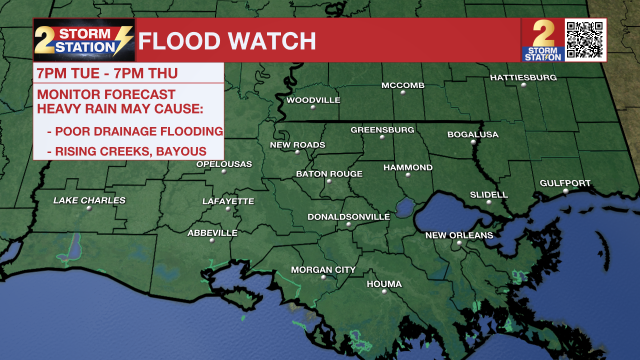

Tonight & Tomorrow: A rapid change will take place on Monday night as a warm front approaches the coast. The all-too-familiar humidity will be felt as early as Tuesday morning. Clouds will increase as well, and some spotty showers will be possible by daybreak. Look for a low in the mid-60s. The warm front will move into the area by afternoon. Along with ample moisture, it will trigger scattered to numerous showers and thunderstorms. Rain coverage and intensity will increase after sunset as an organized complex of thunderstorms moves through. Just about everyone will see rain on Tuesday night. Rain rates will be intense at times, and thunderstorms could repeat over the same locations. As a result, flash flooding is a concern, with areas affected experiencing poor drainage flooding and rapid rises on smaller creeks and streams. The threat of severe weather is not off the table either as some thunderstorms could cause gusty winds and isolated.
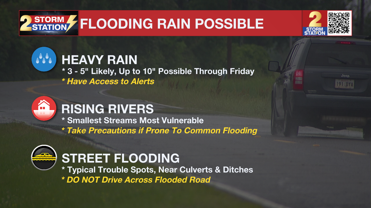
Up Next: Tuesday night's storminess will set the stage what what happens thereafter. That means there are some unknowns in terms of exact timing and coverage on Wednesday. Regardless, leftover moisture and additional disturbances will keep rain chances elevated. The same goes for Thursday. Any extra rain would aggravate the flash flood risk further. All told, 3-6" of rain with locally higher amounts appears likely through the workweek. Most of that will fall through Thursday. Moisture will begin exiting around Mother’s Day Weekend. While a spotty shower cannot be ruled out, the upcoming weekend appears relatively drier.
River Flooding: The National Weather Service has issued a RIVER FLOOD WARNING for the Mississippi River at Red River Landing, Baton Rouge, and Donaldsonville as well as the Atchafalaya River at Morgan City. For the latest levels and forecasts, CLICK HERE.
The Storm Station is here for you, on every platform. Your weather updates can be found on News 2, wbrz.com, and the WBRZ WX App on your Apple or Android device. Follow WBRZ Weather on Facebook and X for even more weather updates while you are on the go.
More News
