

Latest Weather Blog
Friday PM Forecast: cold front to send temperatures tumbling ahead of Thanksgiving
The Capital Area will continue to have warm, quiet weather through much of the weekend. A cold front will bring a chance of showers and thunderstorms Sunday night through Monday, followed by much cooler air into Thanksgiving.
Highs near 80°: over the weekend
Cold Front: showers and a few thunderstorms Monday
Turning Chilly: middle of the week through Thanksgiving

Trending News
Tonight and Tomorrow: For playoff high school football, conditions will stay dry and will be relatively warm compared to last week. Temperatures will be in the upper 60s at the start of the games and will not drop much past the mid 60s by the end. Some lingering clouds are possible through the night, with lows settling in the upper 50s and low 60s. The atmosphere will actually dry out a little on Saturday, resulting in a little less cloud cover. With some extra sun available, highs will reach the upper 70s and low 80s.
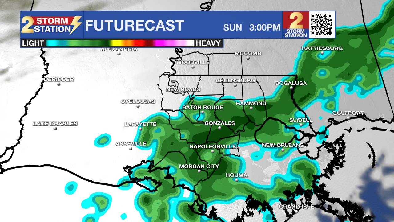
Use the slider to advance through the next 24 hours of Futurecast
Up Next: Sunday will bring another warm afternoon with highs reaching the upper 70s. Plenty of sun early will give way to increasing clouds late. A spotty shower is not out of the question late, but most of the day will be dry.
A cold front will arrive by Monday. While the best energy to support rain and thunderstorms will be well to our north, there should still be enough clouds along with isolated showers and thunderstorms. The atmosphere will be cool enough that some small hail could even fall during any thunderstorms!
Behind the front, a steady cooldown will unfold leading into Thanksgiving. Highs will go from the upper 60s to mid 60s to low 60s on Tuesday, Wednesday, and Thursday, respectively. Lows will bottom out in the upper 30s on Thanksgiving and Friday mornings. There is high confidence in cooler temperatures arriving.
On the other hand, confidence is a little lower with regard to clouds and rain chances during the middle and end of next week. As of now, a largely dry stretch is expected; however, the atmosphere will be in a quickly evolving state and waves of energy could develop that trigger passing showers. Until these fast-moving waves enter the weather balloon network over the western United States, predictability remains lower than average.
Get the latest 7-day forecast and real-time weather updates HERE.
Watch live news HERE.
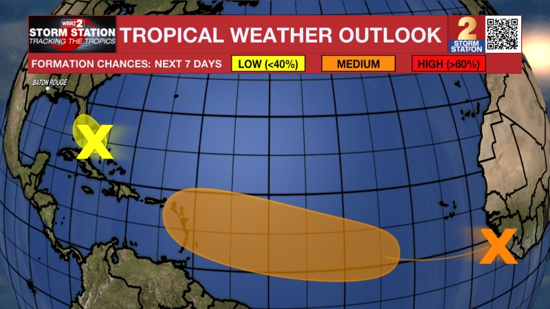
The Tropics: Even as we head toward Thanksgiving, there are two broad areas of low pressure along a front stretching from central Florida out into the Atlantic Ocean. One system near the central Florida coast will stay over land and will not develop further. However, a second system farther east has a medium chance of developing into a subtropical or tropical storm over the next two days as it tracks northward toward the mid-Atlantic coast. Regardless of whether this system earns a name, it will bring heavy rain, gusty winds, and dangerous rip currents to the East Coast from Florida to the Carolinas this weekend.
– Josh
The Storm Station is here for you, on every platform. Your weather updates can be found on News 2, wbrz.com, and the WBRZ WX App on your Apple or Android device. Follow WBRZ Weather on Facebook and X for even more weather updates while you are on the go.
More News

