

Latest Weather Blog
Saturday PM Forecast: First Heat Advisory of 2025 issued; stormy weather on the horizon
Although high heat and steam remain in the forecast, increasing rain chances may provide occasional breaks from the sweltering temperatures.
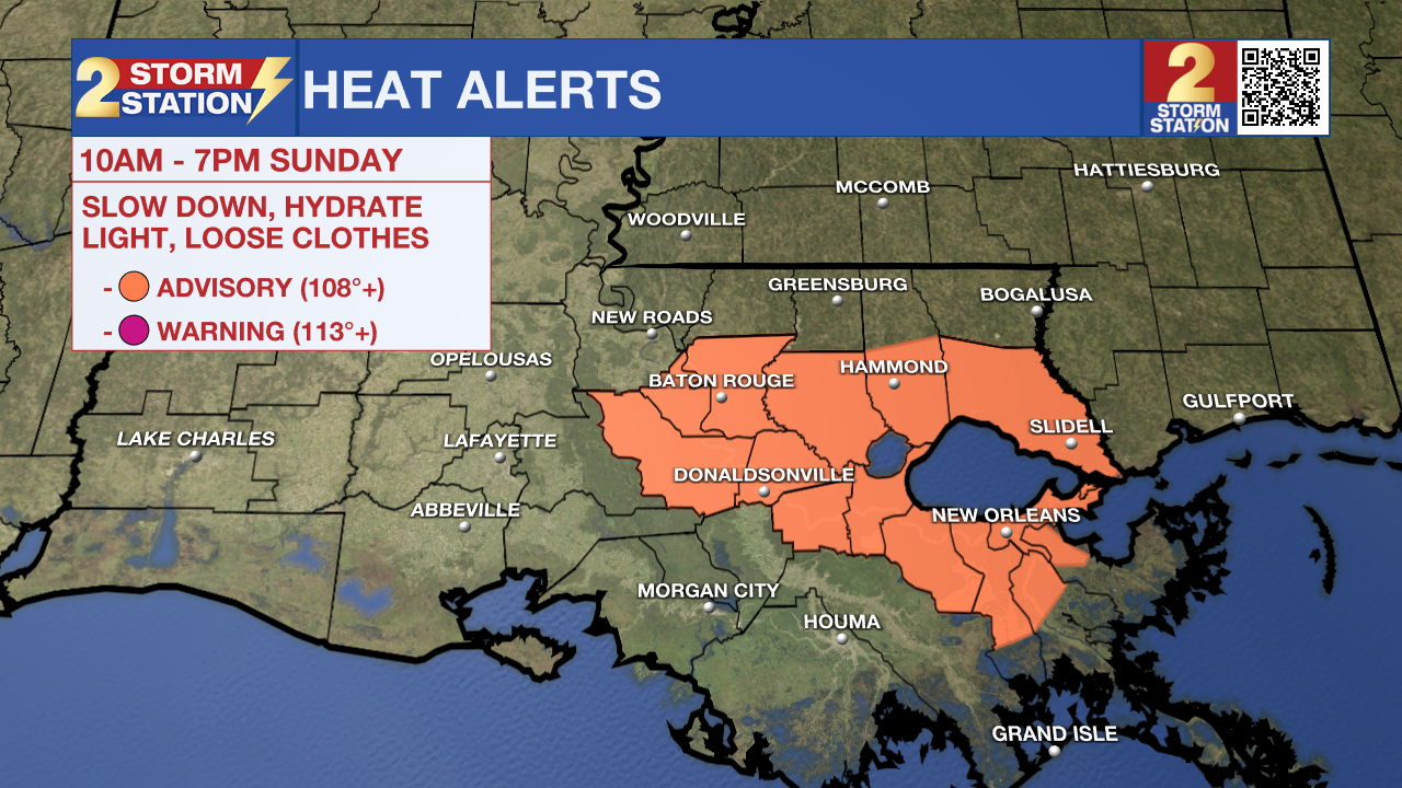
Tonight & Tomorrow: Any leftover pop-up storms will quickly come to an end during the evening. Expect only a few clouds overnight. It will be humid and warm with a morning low in the mid 70s. Sunday will be another hot one. Look for a high in the low to mid-90s, with humidity placing feels-like temperatures upwards of 110°. A HEAT ADVISORY will be in effect from 10 a.m. until 7 p.m. Sunday from Baton Rouge to New Orleans — the first of the year. The combination of heat and high humidity may cause heat illness if not careful. Drink plenty of fluids, wear light clothing, and take breaks during the hottest parts of the day.
That said, there is an opportunity to ring out a rain-cooling shower as a front stalls to the north. This will result in isolated showers and storms, focused primarily during the afternoon and in areas near/north of I-10. One or two could be strong. The main threat would be gusty winds. This might pose some problems for Game 2 of the NCAA Super Regional slated to begin at 5 p.m. at Alex Box Stadium, so keep an eye on the sky and radar. A few storms could linger into the first few hours of the evening before fizzling out. But it won’t take long for rain to make a return appearance.
Up Next: Another disturbance will move into the region on Monday morning. The time of day isn’t most favorable for storms, but a few point locations could come across an early downpour. Then the atmosphere will recharge. By afternoon, there should be sufficient storm fuel to spark a round of scattered showers and storms. Again, a few of these could be strong. Damaging straight-line winds and small hail will be the main threats with the strongest storms, though there would only be a handful of them. While there are still a few unknowns about how the rest of the week plays out, daily downpours do appear likely. Many spots will register an inch or two of rain over the next seven days, with isolated higher amounts. And rain aside, it will still be hot and steamy. Even on days where highs scale back into the 80s, humidity will still make it feel sticky.
The Tropics: The 2025 Atlantic hurricane season is underway. Until it ends on November 30, any important tropical weather information will be provided in this section of the Storm Station Weather Blog. Forecasters from various entities have called for an above-average hurricane season.
For the Gulf, Caribbean, and Atlantic, all is quiet. No tropical development is expected over the next seven days.
Trending News
Get the latest 7-day forecast and real-time weather updates HERE.
Watch live news HERE.
-- Meteorologist Malcolm Byron
The Storm Station is here for you, on every platform. Your weather updates can be found on News 2, wbrz.com, and the WBRZ WX App on your Apple or Android device. Follow WBRZ Weather on Facebook and X for even more weather updates while you are on the go.
More News
