

Latest Weather Blog
Sunday AM Forecast: One more dry day before storms return to the area
UPDATE - 1 p.m. Sunday:
The Storm Prediction Center has upgraded portions of central Louisiana and western Mississippi to a Level 3/5 risk for severe weather for Monday. This zone includes Amite and Wilkinson Counties as well as the northern portions of Pointe Coupee and West Feliciana Parishes. Baton Rouge remains under the Level 2/5 risk for severe weather.
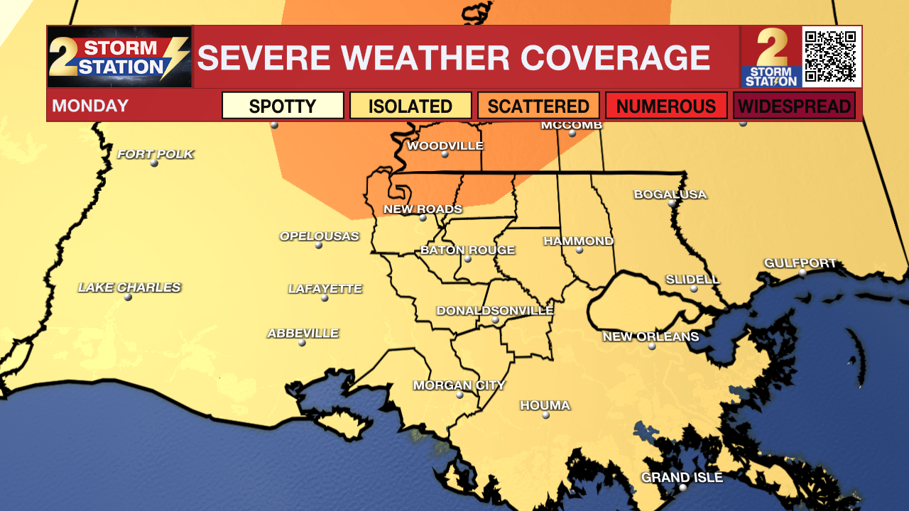
Monday night still looks like the most "active" period as a line of storms passes through. A few line segments may be capable of damaging straight-line winds and/or isolated tornadoes. Pleasure make sure you have a way to receive weather alerts just in case. You can download the free Storm Station Weather App HERE.
The weekend will conclude with some more spring like weather and dry conditions. That will change late tomorrow as our next storm system passes through.
Trending News
Today & Tonight: Clouds are expected to increase in coverage and thicken today. These will mainly be high clouds, but they could get thick enough to block a lot of sunlight. Even though we will have some clouds, highs will be in the upper-70s as winds shift out of the southeast. Overall, today will feel "spring like" and will be a great day for outdoor plans and activities. Tonight, low level clouds will begin to increase in coverage throughout the area. Lows will be near 64 degrees because of all the cloud cover.
Up Next: Clouds will stick around on Monday ahead of our next storm system. Isolated storms will be possible in the daytime hours. Also during this time, winds could get very gusty, even outside of thunderstorms. Winds will be sustained 20-30 mph with gust up to 40 mph. The mostly likely time for storms will be after dark on Monday into early Tuesday as a line of storms rolls through. Storms will likely be at their strongest during this time frame. The Storm Prediction Center has included the Capital Area under a Level 2/5 risk for severe weather. This means isolated instances of severe weather will be possible. Damaging winds appear to be the primary concern, although we cannot rule out a brief spin-up tornado.
We’ll quickly dry out on Tuesday as a quieter pattern settles into the region. Things remain quiet through the rest of the upcoming workweek.
Get the latest 7-day forecast and real time weather updates HERE.
Watch live news HERE.
-- Balin
The Storm Station is here for you, on every platform. Your weather updates can be found on News 2, wbrz.com, and the WBRZ WX App on your Apple or Android device. Follow WBRZ Weather on Facebook and Twitter for even more weather updates while you are on the go.
More News
