

Latest Weather Blog
Sunday PM Forecast: From sizzle to soak, soggy pattern to follow early-week heat
The National Weather Service has issued a HEAT ADVISORY for the majority of southeast Louisiana. It will go into effect at 10 a.m. and last until 7 p.m. Monday. Heat index values, or feels-like temperatures, may approach 112° in a few neighborhoods. Such a combination of heat and humidity could lead to heat illnesses if not careful. The advisory serves as a reminder to drink plenty of fluids, take it easy outdoors during peak heating. It’s also a good idea to check on individuals at higher risk for heat-related illness, including older adults and young children.
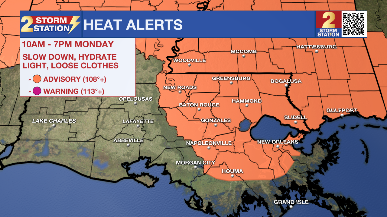
Tonight, Tomorrow, & Tuesday: Expect nothing out of the ordinary on Sunday night — mostly clear skies with lows settling in the mid 70s. Once the sun rises, temperatures will be off to the races. Heat will remain in the spotlight on Monday as highs soar into the mid 90s. Humid conditions will make it feel roughly 10-15° warmer during the afternoon, enough to prompt a Heat Advisory (see above). A stray sprinkle cannot be ruled out, but don’t count on them. They will be tough to find. An expansive ridge of high pressure responsible for Monday’s heat will remain overhead on Tuesday. In so doing, high heat and limited rain chances will linger for an extra day. Another Heat Advisory is likely to be issued for Tuesday.
Wednesday & Beyond: Much like last week, another surge of tropical moisture is set to target the Capital Region. While Wednesday likely starts off dry with some sun, returning moisture will allow for an uptick in storms by afternoon or evening. The timing of the those will play a big role in how hot things get on Wednesday. A tropical disturbance will excite an even greater coverage of storms on Thursday and Friday, helping to knock temperatures back a bit. Moisture left behind will keep daily storm chances in play through the weekend. Roughly 1-3” of rain will fall in many locations in the next week. Isolated higher amounts will be possible, especially near the coast. Details are still coming into focus, so be sure to stay connected in the coming days.
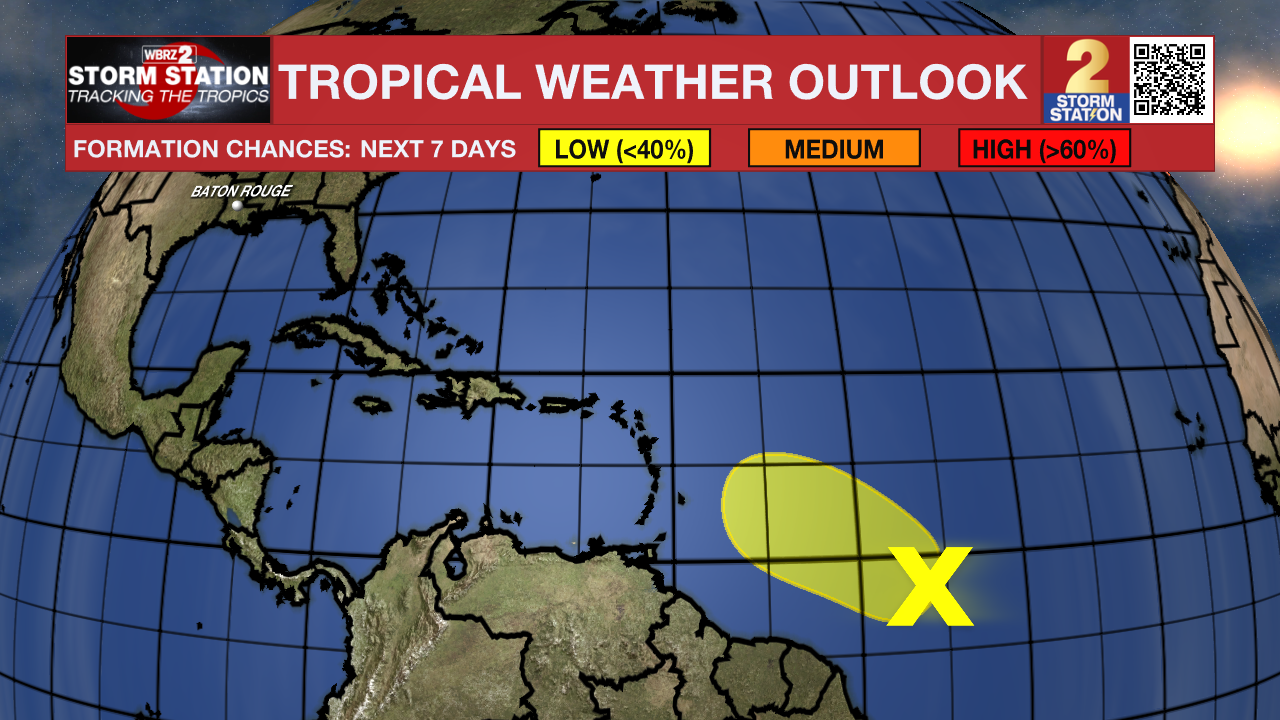
The Tropics: A tropical wave located about 1,000 miles east-southeast of the Lesser Antilles remains disorganized. Environmental conditions appear slightly favorable for tropical development in the next day or so. Even so, development odds are low. The system will enter a hostile environment by midweek, making further development unlikely.
Trending News
Get the latest 7-day forecast and real-time weather updates HERE.
Watch live news HERE.
— Meteorologist Malcolm Byron
The Storm Station is here for you, on every platform. Your weather updates can be found on News 2, wbrz.com, and the WBRZ WX App on your Apple or Android device. Follow WBRZ Weather on Facebook and X for even more weather updates while you are on the go.
More News
