

Latest Weather Blog
Sunday PM Forecast: Inching closer to 90 degrees as dry spell continues
There's little hope for rain this week as sunshine appears to dominates yet again. And temperatures will climb as we leave behind the first fall chill.
Tonight & Tomorrow: With clear skies and low wind speeds, the Capital Area will face another cool night. Look for a morning low in the low-50s in Baton Rouge. The typical cool spots to the north of the interstate system might end up in the upper-40s. Similar to recent days, the cool morning air will quickly warm up with abundant sunshine during the day. Expect a high temperature in the mid-80s across the region on Monday. The humidity will remain low, making for another pleasant day.
Up Next: The rest of the week features a continuation of the same sunny pattern, but temperatures will be on the rise. Both highs and lows inch higher with each passing day, running about 5-10° average for much of the week. By late week, the region will be facing highs in the upper-80s with lows in the upper-50s to low-60s. While the latest Storm Station forecast does not explicitly call for 90s, it will be a close call on a few days. It is also worth noting that record highs hover right around 90° this time of year.
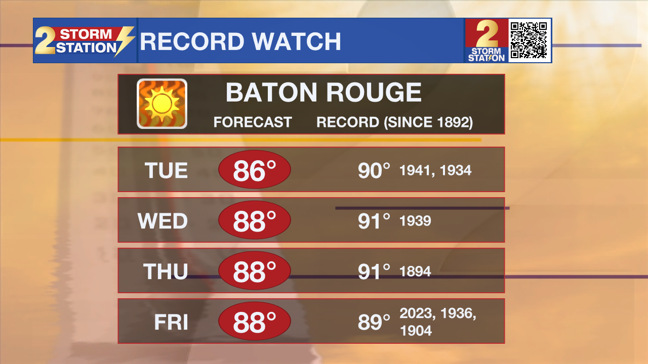
Rain will also avoid the Capital Area for another week. Only 0.13" of rain has been recorded at Metro Airport this October. And based on current trends, it's possible that this October could rank as one of the top 10 driest. The Storm Station will be keeping an eye on the drought status as a result. The next update comes on Thursday.
Trending News
Get the latest 7-day forecast and real time weather updates HERE.
Watch live news HERE.
The Tropics: Oscar made landfall twice on Sunday, first on Great Inagua Island early in the morning and then in eastern Cuba in the afternoon. Oscar is a tiny system, ranking as one of the smallest hurricanes on record. The storm will weaken as it interacts with land on Sunday night. However, Oscar will eventually recurve northeast over water on a path toward the Bahamas. The system is forecast to maintain tropical storm status as it passes by the Bahamas. By midweek, increasingly hostile conditions will allow the storm to dissipate.
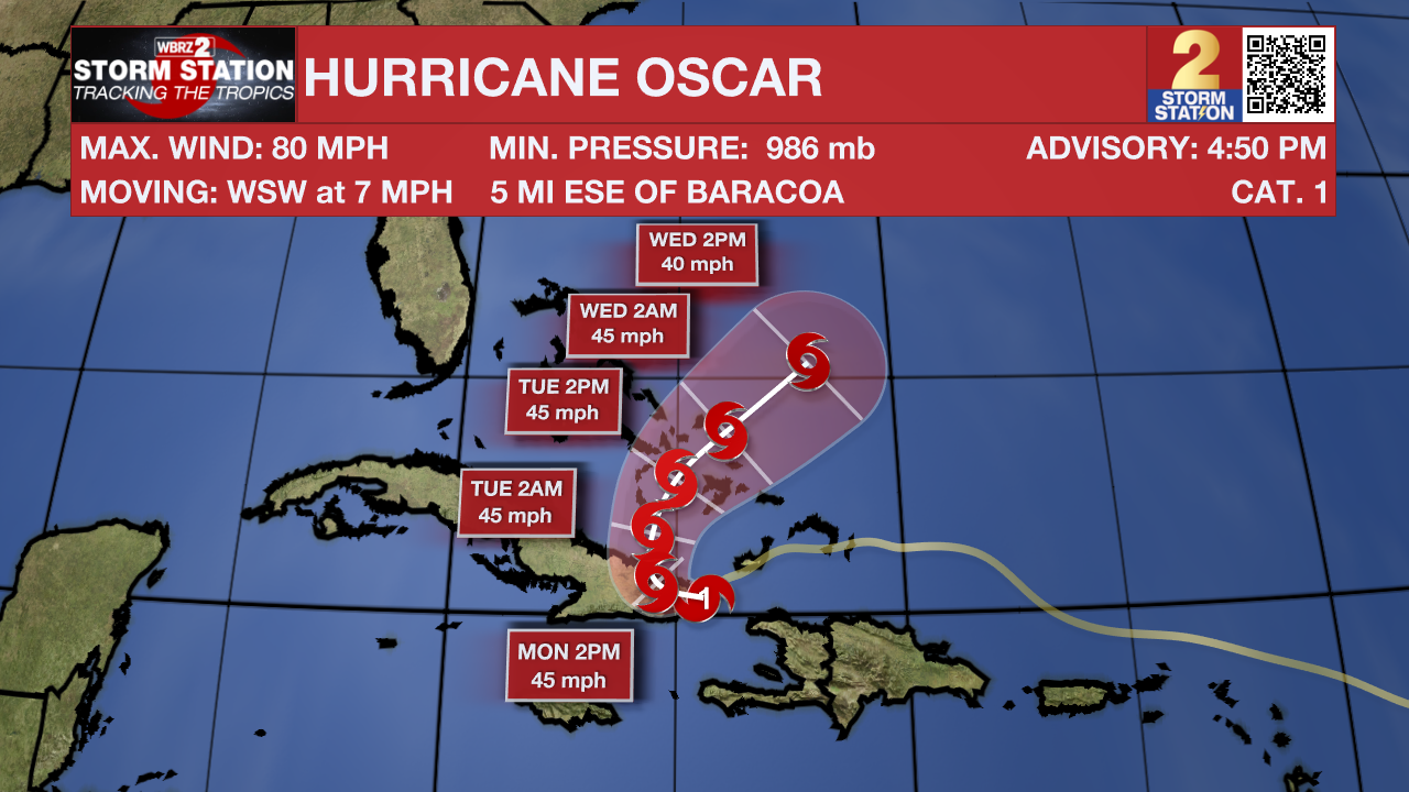
Oscar is the only active storm, and no other tropical development is expected in the next seven days.
-- Meteorologist Malcolm Byron
The Storm Station is here for you, on every platform. Your weather updates can be found on News 2, wbrz.com, and the WBRZ WX App on your Apple or Android device. Follow WBRZ Weather on Facebook and Twitter for even more weather updates while you are on the go.
More News
