

Latest Weather Blog
Thursday AM Forecast: Cloud cover adding a twist to the Fourth of July forecast
As scattered showers and storms taper in the days ahead, the door opens up for hotter afternoon temperatures. But there's a new forecast wrinkle which might take the edge off the heat on Independence Day.
Today & Tonight: Summer heat will remain in place on Thursday. Look for a high in the mid 90s under a mixture of clouds and sun. Peak feels-like temperatures will be in the 100-105° range despite high humidity, slightly under Heat Advisory criteria. Pop-up showers and storms will be a possibility as the day wears on, but the amount of moisture to support them will be in question. Enough will be in place to support spotty activity (~20% coverage) at least. However, a slight increase in moisture levels could nudge rain chances slightly higher.
Cloud cover will ramp up during the evening hours — that’s new to the Storm Station forecast as of this morning. The rest of the night will be mostly cloudy as a weak passing disturbance moves through. It might even be enough to ring out a few showers overnight. Overnight lows will be a little warmer in turn, in the mid to upper 70s.
Fourth of July & Saturday: Cloud cover now appears to linger for the first half of Independence Day. This will help take the edge off the heat. Afternoon sun should push thermometers past 90° by the end of the day, but a delayed warmup could spare the area from a Heat Advisory. If outside for an extended period of time, still make sure to stay hydrated. A spotty shower or storm cannot be ruled out either. For WBRZ’s Fireworks on the Mississippi, any leftover rain will be wrapping up. Skies will clear and temperatures will ease into the mid 80s. A push of dry air will finally work into the region on Saturday, keeping rain chances to a minimum. With little rain and plenty of sun, highs should reach the mid 90s.

Looking Beyond: Moisture will seep back into the region Sunday through Tuesday. This will help to ignite isolated to scattered showers and thunderstorms. Thanks to a pocket of disturbed air aloft, the showers and thunderstorms may not necessarily be limited to afternoons, but will be enhanced by daytime heating.
Trending News
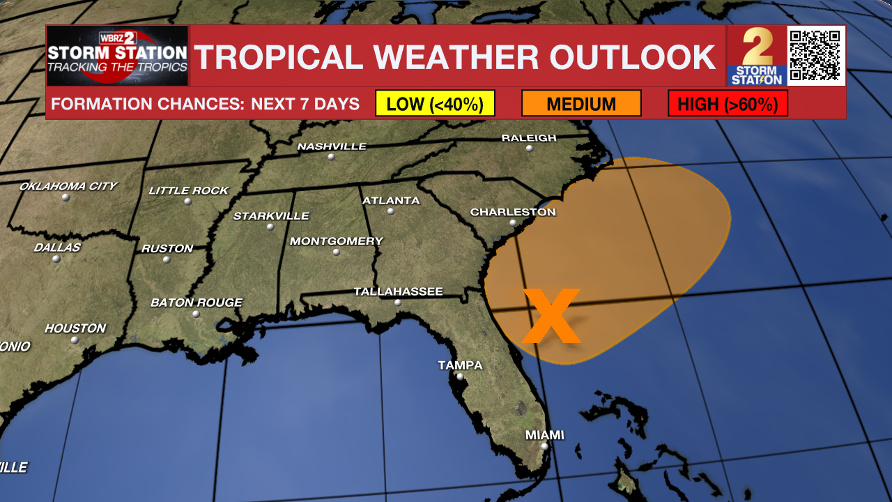
The Tropics: An area of low pressure will develop along a weakening front near Florida along the Southeast Coast by the weekend. Conditions appear conducive for slow development. A tropical or subtropical depression could form in that area over the weekend or early next week while the system drifts northeastward. Regardless of development, heavy rain is possible across parts of the southeast United States. Local impacts from this system are not expected.
Get the latest 7-day forecast and real-time weather updates HERE.
Watch live news HERE.
— Meteorologist Malcolm Byron
The Storm Station is here for you, on every platform. Your weather updates can be found on News 2, wbrz.com, and the WBRZ WX App on your Apple or Android device. Follow WBRZ Weather on Facebook and X for even more weather updates while you are on the go.
More News
