

Latest Weather Blog
Wednesday PM Forecast: Facing a prolonged stretch of heat; busy out in the Atlantic
Diminishing afternoon storm chances will make way for one of the hottest stretches of the year, featuring a run of highs in the upper 90s. Meanwhile, tropical activity is ramping up in the Atlantic with the formation of a new tropical storm and a few other systems to watch.
Tonight & Tomorrow: Showers and skies will clear out during the evening, leading to a mostly clear and seasonably warm night across the Capital Area. Weather conditions will be ideal for viewing the Perseid meteor shower, which reaches its peak tonight — CLICK HERE for more information. Temperatures will fall through the 80s before midnight and eventually settle in the mid-70s around dawn.
Expect a hot day on Thursday with rain becoming increasingly scarce. A thin layer of Saharan dust overhead may shave a degree or two off highs by filtering the sunlight, but temperatures will still reach the mid-90s. Peak feels-like temperatures could reach 108° due to humidity, prompting a Heat Advisory for much of the region. That serves as a friendly reminder to drink plenty of water, take breaks in the shade, and avoid overexertion when spending time outdoors.
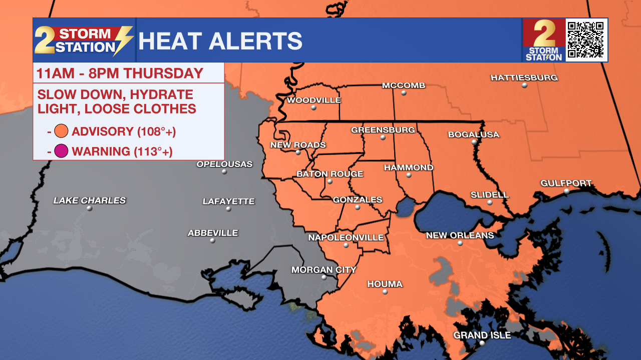
Up Next: A massive ridge of high pressure will set up shop over the Gulf Coast moving into the weekend. The ridge will squash rising air, effectively shutting down thunderstorms and allowing heat to build. Highs will soar into the upper 90s starting Friday. While not impossible, afternoon showers will be few and far between through the weekend, so don’t count on any major rain. Drier air filtering down to the surface Friday and Saturday will offer slight relief from the humidity, but that effect fades by Sunday. As high temperatures stay in the upper 90s, rising humidity will push heat index values over 108 degrees at times, likely triggering additional heat alerts.

Those working outdoors will need to take frequent shaded breaks, drink plenty of water, and stay alert for the signs of heat exhaustion. This is especially true heading into next week, as prolonged heat creates a cumulative strain on the body with each consecutive day. Additionally, the heat combined with minimal rainfall could trigger rapid drought development across the area. The Storm Station team will continue to monitor conditions closely.
Trending News
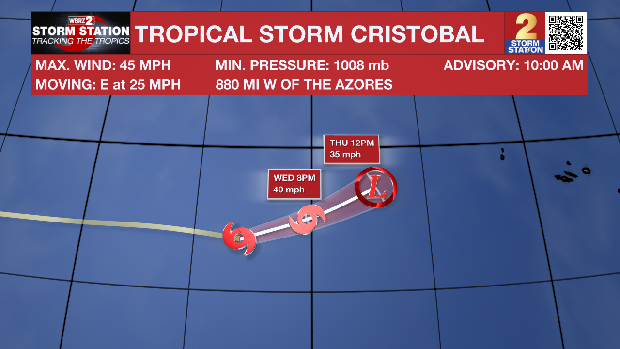
The Tropics: Tropical Storm Cristobal formed in the subtropical Atlantic on Wednesday morning. It’s a weak system that is moving away from North America. Cristobal will likely become post-tropical in the next day or so as it moves into the cooler waters of the North Atlantic. Its remnants may brush the Azores late in the week, but minimal impacts are expected.
Meanwhile, there are two other areas of interest in the much warmer tropical Atlantic. The westernmost disturbance has a high probability of tropical development in the next 48 hours. The latest forecast guidance has shifted south, favoring a track toward the Lesser Antilles by the weekend and into the Caribbean next week. In a typical year, this would raise alarms for a possible track in the Gulf. However, strong wind shear boosted by El Niño and dry air will suppress the system in the Caribbean. This system does not appear to pose any threat to the Gulf Coast.
Another tropical wave trailing behind, positioned farther to the east, now has a medium chance of tropical development over the next week.

Get the latest 7-day forecast and real-time weather updates HERE.
Watch live news HERE.
— Meteorologist Malcolm Byron
The Storm Station is here for you, on every platform. Your weather updates can be found on News 2, wbrz.com, and the WBRZ WX App on your Apple or Android device. Follow WBRZ Weather on Facebook and X for even more weather updates while you are on the go.
More News

