

Latest Weather Blog
All clear, severe weather threat ends for Capital Area
The threat of severe weather has ended for the night. Cooler and quieter weather is ahead to conclude the workweek.
Tonight and Tomorrow: Though showers and thunderstorms will continue to move away to the southeast, clouds will persist through much of the night. Behind a cold front, winds will turn around to the northwest at 10-20mph and pull in cooler air with lows settling around 49 degrees. Temperatures will be noticeably cooler on Thursday, but close to normal for February. Expect highs near 64 degrees. Though the low levels will be dry, and rain is not expected, moisture in the upper levels will keep some high clouds around filtering sunshine at times.
Friday: After starting off in the 40s, some sunshine will be available early Friday. As a warm front lifts north through the region, clouds will increase. Building clouds should put a cap on afternoon temperatures in the mid-60s.
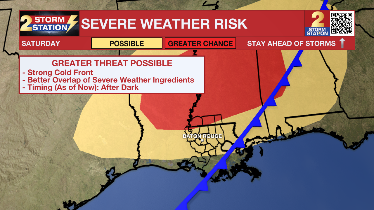
Saturday: To start the weekend, expect warm and breezy conditions, with temperatures soaring into the low to mid-80s—possibly near record highs. Winds out of the south at 15-25mph will be noticeable, with gusts up to 35 mph at times. The stubborn front will finally get a strong push south late in the day and overnight, bringing rain and the risk of severe thunderstorms as this happens (see below).
Trending News
Next Severe Weather Chance – Being several days out, there are still a lot of unknowns with how everything plays out on Saturday. There is support for a strong upper-level disturbance swinging through the region. If it takes the right track, most ingredients would be in place to support severe thunderstorms. The Storm Prediction Center highlights much of the area as having the potential for severe weather on Saturday—especially during the evening and overnight. Details should come into focus later in the week as the responsible disturbance moves over the West Coast.
Sunday & Beyond: The cold front will clear out early Sunday, leading to sunny and much cooler weather. Highs will only reach the 60s on Sunday before lows bottom out near freezing on Monday morning. Temperatures will remain a few degrees below average into Tuesday.
Get the latest 7-day forecast and real-time weather updates HERE.
Watch live news HERE.
– Josh
The Storm Station is here for you, on every platform. Your weather updates can be found on News 2, wbrz.com, and the WBRZ WX App on your Apple or Android device. Follow WBRZ Weather on Facebook and X for even more weather updates while you are on the go.
More News
